Hiking in Andorra means 468 km² of Pyrenees with three nature parks (one a UNESCO World Heritage valley), more than 80 glacial lakes, about 30 mountain huts and a 2,942 m highest point — Coma Pedrosa. The season runs roughly mid-June to mid-October, the best lake hikes take half a day, and buses reach most trailheads for a couple of euros.
That paragraph is the country in miniature, and it still undersells the place. Andorra has spent decades being described as a duty-free car park with ski lifts, and the description has stuck so well that the mountains themselves — the actual substance of the country, roughly 90% of which is undeveloped rock, forest, meadow and water — barely figure in most people’s mental image of it. The skiers know about the winter version. The summer version, where the same terrain turns into one of the densest little hiking networks in Europe, is still strangely under-visited by everyone except the Catalans and the French, who have been quietly walking it for generations and would probably prefer I didn’t tell you.
I’ve walked in this country in every month from May to November — sweated up the Coma Pedrosa scree in August, had Sorteny’s wildflowers entirely to myself on a Tuesday in early July, been turned around by an afternoon storm above the Juclar lakes, and once shared the Engolasters loop with what felt like half of Andorra la Vella on a Sunday. This guide is the article I wish had existed before any of that: every hike that’s actually worth your legs, ranked honestly by what you put in against what you get back, plus the practical machinery — buses, huts, seasons, road closures — that the prettier guides skip.
The short answer
If you only have one half-day, do the Tristaina lakes loop from Ordino Arcalís — three glacial lakes in 4.4 km, the best effort-to-reward ratio in the country. If you have one full day and strong legs, climb Coma Pedrosa, the 2,942 m roof of Andorra. If you want the country at its most photogenic with almost no climbing, walk the Vall d’Incles valley floor and on up to the Juclar lakes, the largest in Andorra. If you’re travelling with children or tired legs, it’s Lake Engolasters and the Ruta del Ferro. And if you have five days and hut-to-hut ambitions, the Coronallacs — 92 km linking all four staffed refuges — is one of the great unsung treks of the Pyrenees.
Everything below exists to put numbers, bus lines and honest difficulty grades behind those recommendations — and to cover the twenty-odd other trails that didn’t make that paragraph but might deserve a place in your week.
A country that is mostly mountain
Some context makes the trail list make sense. Andorra is the sixth-smallest country in Europe: 468 km², about two and a half times the size of Washington DC, wedged between France and Spain at the eastern end of the high Pyrenees. Its lowest point is 840 m — higher than the summit of Snowdon’s little brother — and its highest is 2,942 m, with some 65 peaks over 2,000 m crammed in between. Nothing in the country is flat. The towns occupy the valley floors, the roads follow the rivers, and everything else — roughly nine-tenths of the national territory — is mountain.
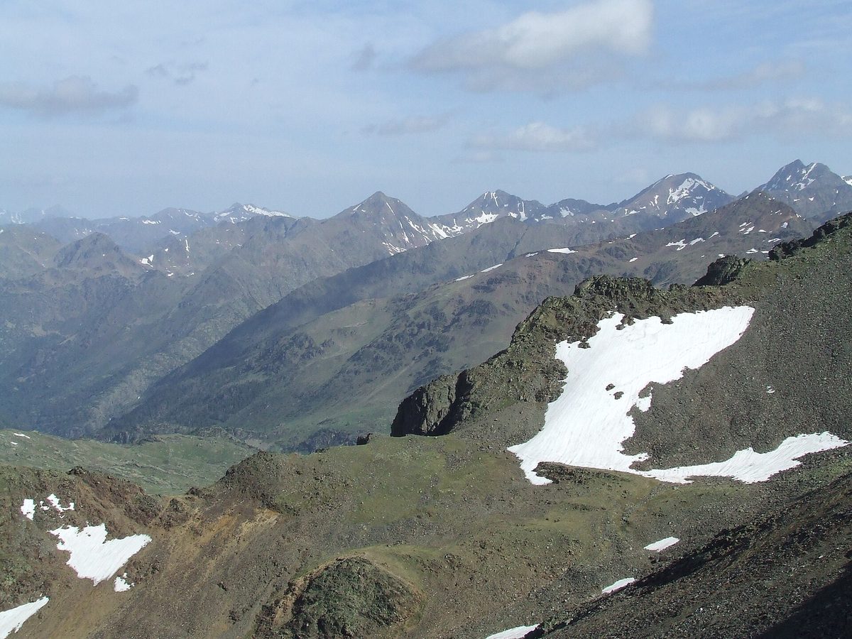
Three chunks of that territory are formally protected, and together they cover almost 15% of the country, which is a remarkable figure for a state this small. The Sorteny Valley Natural Park (1,080 hectares, in Ordino) is the wildflower one. The Comapedrosa Valleys Natural Park (15.42 km², in La Massana) is the high, rocky one with the country’s highest summit. And the Madriu-Perafita-Claror Valley (4,247 hectares — 9% of Andorra by itself) is the roadless one, a glacial valley so intact that UNESCO inscribed it as a World Heritage cultural landscape in 2004. Scatter more than 80 lakes and ponds across all that — the legacy of the glaciers that carved every valley here — and you start to see why the hiking is so good: the country is essentially one connected high-mountain playground with a few towns at the bottom of it.
Two more structural facts work enormously in your favour. First, distances are tiny: from Andorra la Vella, every trailhead in this guide is within about 35 minutes by road. You can sleep in one hotel all week and hike a different valley every day, which is exactly what I’d do — the where-to-stay guide covers which base suits which trip. Second, the national bus network reaches most of those trailheads. Hiking in Andorra without a car isn’t a compromise; for a few of the best valleys, where summer road closures apply, the bus is actually the smarter way in.
Every hike in this guide, ranked by effort and reward
The table below is the whole article in one view. Distances are round trip unless marked one-way; times are honest mid-pack hiking times, not trail-runner times. “Reward” is my call after walking all of them — argue with me by email.
| Hike | Start | Distance | Climb | Time | Level | The payoff |
|---|---|---|---|---|---|---|
| Lake Engolasters & Circuit de les Fonts | Engolasters | 5.6 km loop | 136 m | 1.5–2 h | Easy | Lake, forest, capital views for nothing |
| Ruta del Ferro | Llorts | 4.2 km one-way | 126 m | 1.5 h | Easy | Iron-mine history, prettiest villages |
| Camí del Gall | Canillo | 5.9 km one-way | 285 m | 2 h | Easy | Bridges, a tunnel, balcony views |
| Vall d’Incles floor | Incles | up to 7 km | ~100 m | 1–2 h | Easy | Andorra’s prettiest valley, flat |
| Tristaina lakes | Ordino Arcalís | 4.4 km loop | ~200 m | 2.5–3 h | Easy-mod | Three glacial lakes, minimal effort |
| Estanys de Juclar | Vall d’Incles | 9.2 km | 465 m | 3.5–4 h | Moderate | The country’s biggest lake, staffed hut |
| Estany de Cabana Sorda | Vall d’Incles | 9.7 km | ~550 m | 3.5–4 h | Moderate | Lake-and-cirque perfection, quieter |
| Pessons cirque | Grau Roig | 12.1 km loop | 792 m | 4.5–5.5 h | Moderate+ | Six lakes and a 2,862 m summit |
| Pic de Casamanya | Coll d’Ordino | 7.5 km | 750 m | 3.5–4 h | Moderate+ | The best 360° view in Andorra |
| Estanys de l’Angonella | Llorts | 10.9 km | 1,015 m | 5–6 h | Hard | Three lonely lakes, wild horses |
| Estany de la Nou (Madriu) | Engolasters road | 17.3 km loop | 1,235 m | 6–7 h | Hard | The UNESCO valley at its best |
| Pic de l’Estanyó | Sorteny | 11.7 km loop | 1,135 m | 5.5–6.5 h | Hard | A 2,915 m summit from a flower garden |
| Coma Pedrosa | Arinsal | 13.7 km | ~1,400 m | 6–8 h | Hard+ | The roof of Andorra, 2,942 m |
| Coronallacs | Escaldes | 92 km | 6,868 m | 5 days | Very hard | The whole country, hut to hut |
Now the detail, grouped the way you’ll actually choose: by the kind of day you want.
The easy walks that are actually worth it
Every mountain destination pads its brochure with dull valley strolls. Andorra’s easy walks are better than that — several of them are the equal of anything in this guide for scenery-per-step, and they’re the right call for your first day at altitude, for children, or for the afternoon after a big morning.
Lake Engolasters and the Circuit de les Fonts
Engolasters is the only sizeable lake in Andorra below 2,000 m, which makes it the only one you can drive to in ten minutes from the capital — and on summer Sundays it shows. Go early or go on a weekday. The classic outing is a 5.6 km loop combining the lake circuit with the Circuit de les Fonts, a nearly flat forest path strung with springs, picnic clearings and a lookout over Andorra la Vella, about 136 m of total climbing. The lake itself is a 7-hectare reservoir feeding a 1930s hydroelectric station, rimmed with black pines and usually mirror-still in the morning. There’s a treetop adventure park (Bosc Aventura) by the parking if your party includes anyone under twelve who needs tiring out. It’s the obvious first-evening walk if you’re staying in Andorra la Vella or Escaldes.
Ruta del Ferro (the Iron Route)
From the hamlet of Llorts in the Ordino valley, this 4.2 km one-way amble (126 m of gain) follows the river past iron sculptures that narrate the parish’s mining and forging history, ending at La Cortinada beside the lovely Romanesque church of Sant Martí. The Llorts mine itself — a 30 m gallery into the hillside — opens for guided visits in summer. It sounds like a school trip; it walks like a postcard. Ordino’s stone villages are the prettiest in the country, and this is the laziest possible way to see them strung together. Bus L6 runs the valley, so you can walk one way and ride back.
Camí del Gall
Canillo to Soldeu, 5.9 km, 285 m up, waymarked with a red rooster. It’s a balcony path above the Valira d’Orient with a tunnel, wooden bridges, one short chain-assisted section to keep children interested, and constant views across to the Grandvalira slopes wearing their summer green. Do it downhill (Soldeu to Canillo) if you want it even easier, and bus L4 shuttles you back to your starting point either way.
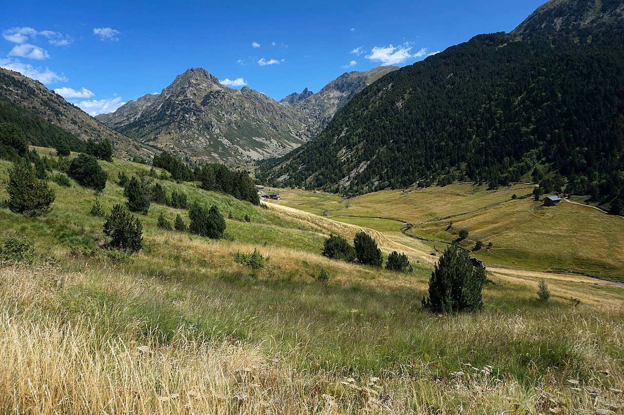
The Vall d’Incles floor
The Incles valley near Soldeu is the single prettiest piece of flat ground in Andorra — a textbook U-shaped glacial valley of hay meadows, stone bordes and a lazy river, walled by 2,800 m peaks. In summer (roughly late June to early September) the dead-end road up the valley is closed to cars from 9:00 to 18:00, which transformed it from a traffic jam into a paradise: you park at the valley mouth (or arrive on bus L4) and walk or ride the little electric shuttle train up the 3 km of valley floor. As a walk it’s barely a hike at all. As a place to be on a July morning, it has no rival in the country. It’s also the launchpad for two of the best lake hikes below.
The lake hikes: Andorra’s signature day out
If Andorra has a signature hike, it’s this genre: climb a glacial valley for an hour or three, arrive at impossibly blue water in a granite bowl, eat your sandwich, swear you’ll move here. The glaciers left the country more than 80 lakes and ponds, and the only real problem is choosing among them. These six choices cover the spread from family-friendly to leg-breaking.
Estanys de Tristaina — the best effort-to-reward in Andorra
Three lakes — Primer, del Mig and Més Amunt — stacked in a cirque on the French border above the Ordino Arcalís ski area. The official loop is just 4.4 km with about 200 m of climbing, call it two and a half to three hours with proper lake-gazing stops, on good trail the whole way. You get genuine high-Pyrenean scenery — the lakes sit at around 2,300 m — for the effort of a city park run, which is why I send everyone here first. Go before 10:00 or after 16:00 in July and August; the secret is comprehensively out. Note the summer road closure: from roughly mid-July to mid-September the final stretch of road to the Arcalís lots closes to private cars during the day (about 8:30 to 17:30), with parking lower down and a path or shuttle covering the difference — check the Ordino Arcalís site before driving up.
Two upgrades if your legs agree. The Mirador Solar de Tristaina, a 25 m steel ring cantilevered off the summit of Pic de Peyreguils at 2,701 m, stares down at all three lakes and across half the Pyrenees; hike up to it via the Creussans side (turning the outing into a ~6 km, 500 m day) or cheat with the Tristaina cable car and Creussans chairlift, running 6 June to 1 November in 2026, €22 return for the pair. Purists grumble about lift hardware in summer; I’d point out the lifts also run mountain-bike and family traffic that would otherwise be on the trail with you. The second upgrade is the quieter Estany de Creussans itself, a fourth lake most day-trippers skip.

Estanys de Juclar — the biggest water in the country
From the top of the Vall d’Incles, a steady 4.6 km climb (465 m) of switchbacks, stream crossings and one short rocky steepening brings you to Estany Primer de Juclar — at 21.3 hectares the largest lake in Andorra, with a second lake just beyond and the staffed Refugi de Juclar sitting photogenically on the shore of the first. The hut serves drinks and meals in season, which converts a good hike into a very good lunch. Round trip about 9.2 km; allow four hours plus terrace time. Start early in summer: the trail is the most popular in the valley, and afternoon storms build fast on this border ridge — I’ve watched a flawless morning turn to thunder here by 14:30.
Estany de Cabana Sorda and Estany de l’Isla
Same valley, fewer people. Cabana Sorda is the connoisseur’s Incles lake: a 9.7 km out-and-back (roughly 550 m of climbing) to a lake backed by a wall of grey peaks, with a free stone hut by the shore. The view down the length of the Incles valley from the upper switchbacks is, for my money, the best mid-hike view in eastern Andorra. Strong walkers can fold in Estany de l’Isla — a lake with its own tiny island, crossed by a line of stepping-stone rocks — for a ~12 km, 700 m circuit that ranks among the most underrated days in the country.
Estanys de Pessons — six lakes and a summit
From Grau Roig (the quiet pocket of the Grandvalira ski area), a chain of six lakes climbs a granite cirque to the 2,862 m Pic dels Pessons. The full loop with the summit is 12.1 km and 792 m of gain — four and a half to five and a half hours — but the genius of Pessons is that it rewards any turnaround point: the first lake arrives in under half an hour (with a restaurant beside it, this being Andorra), the crowds evaporate after the second, and from the peak you count all six below you like spilled coins. In late June there can still be snow patches near the top; in late September the grass turns copper and it’s the best autumn walk in the country, a point I expand on in the month-by-month guide.
Estanys de l’Angonella — for people who want nobody around
Three lakes in a hanging valley above Llorts, reached by a relentless 5.4 km, 1,015 m climb that filters out 95% of the people who photographed Tristaina that morning. The reward is solitude of a kind that’s becoming rare in the Pyrenees, frequent wild horses in the upper meadows, and water so clear the trout look like they’re levitating. Hard, honest, unglamorous, magnificent.
Estanys de la Vall del Riu — the quiet classic
From the Ransol valley, 5.9 km one-way and 720 m up through pine and aspen to a shelf holding three lakes, the biggest of them — Estany Gran de la Vall del Riu, about 4 hectares — among the largest in Andorra. It’s the lake hike I recommend when someone wants Juclar-grade scenery without Juclar-grade company. The stone houses at Els Plans, where the trail starts, are what every Alpine pastiche resort is trying to imitate.
The big days: Andorra’s peaks
Andorra has around 65 summits over 2,000 m and seven over 2,900 m, and almost all of them are walkable — no glaciers, no permanent snowfields, no ropes on the standard routes. These are the five that justify the sweat.
Coma Pedrosa, 2,942 m — the roof of the country
The highest point in Andorra, climbed from Arinsal through the Comapedrosa Valleys Natural Park: 13.7 km round trip, around 1,400 m of total climbing, six to eight hours. It’s a proper mountain day in three acts. Act one is forest and waterfall to the Pla de l’Estany shelf. Act two crosses the park’s heartland to the Refugi del Comapedrosa at 2,260 m — staffed, 45 places, open 1 June to 12 October, serving lunches with a terrace view that makes the first 700 m of climbing feel like an entrance fee fairly charged. Act three is the business: up past Estany Negre into a grey lunar bowl, then the final ridge, where hands come out of pockets for a short, easy scramble to the summit. From the top you see Aneto and the whole Pyrenean crest one way and, on clear days, halfway to the Mediterranean the other.
Honest warnings: snow patches linger on the upper route into early July; the final ridge is no place for a first-ever scramble in wet weather; and the round trip from Arinsal village adds distance if you don’t start at the park’s main car park. Bus L5 from La Massana drops you in Arinsal, which puts the highest summit in the country within reach without a car. If a full traverse appeals, hardened walkers link Coma Pedrosa with Pic de Medacorba (the three-border peak of Andorra, France and Spain) in a 16 km, 1,800 m horseshoe that is the most serious commonly-done day in Andorra — experienced parties only, and not in June snow.
Pic de Casamanya, 2,740 m — the best view-per-hour
Casamanya sits dead-centre in the country, which means its summit panorama is a 360° map of everything else in this article. From the Coll d’Ordino road pass at about 1,980 m it’s only 3.75 km and 750 m each way — a half-day — up a path that’s never technical, just steadily, charmlessly steep once the trees give out. Locals run it before work. Go on a clear morning, take a windproof (the summit is famously gusty), and you’ll understand the whole geography of Andorra in one slow turn. This is the peak I’d give someone who has exactly one summit in their legs.
Pic de l’Estanyó, 2,915 m — the connoisseur’s summit
Climbed as an 11.7 km, 1,135 m loop from the Sorteny valley, past the Estany de l’Estanyó lake and onto one of the country’s seven 2,900-ers. Quieter than Coma Pedrosa, prettier underfoot (you start in a botanical park, literally), and the ridge views into both the Sorteny and Ransol valleys are superb. The descent past the staffed Borda de Sorteny refuge offers the best post-summit terrace meal in Andorra.
Alt del Griu, 2,879 m — the workout with lakes attached
From Cortals d’Encamp (you can ride the Funicamp gondola partway in high summer and shortcut the dullest stretch), 6 km one-way and 985 m up past the Ensagents lakes to the highest point of Encamp parish. It’s the summit for repeat visitors — less famous, no crowds, alpine lakes in a high granite bowl, and an unbeatable angle on Casamanya across the valley.
The Madriu-Perafita-Claror: hiking the UNESCO valley
The Madriu is the anomaly that explains old Andorra. There is no road into it — none — just mule paths entering a 4,247-hectare glacial valley system that covers 9% of the country and carries a UNESCO World Heritage inscription (2004) not for its scenery, which is glorious, but as a cultural landscape: terraced fields, drystone walls, shepherds’ bordes, iron-smelting sites and a communal land-ownership system documented back to the 13th century and still in operation. Walking in, the 21st century switches off behind you with an almost audible click.
The classic full-day route is the Estany de la Nou loop from the Madriu parking on the Engolasters road: 17.3 km and about 1,235 m of climbing through the lower valley to the Fontverd hut, up over the Coll de Mainana with the lake glittering below, then home past the Perafita hut — six to seven hours of the best varied walking in Andorra. Gentler options exist: the lower valley path to Entremesaigües and Ramio (oak and birch woods, river pools, hay meadows) makes a fine out-and-back of two to three hours that children manage happily. Deeper in, the staffed Refugi de l’Illa (a Coronallacs stage stop) anchors the valley’s upper end below the Estany de l’Illa. However far you go, go: nothing else in the Pyrenees feels quite this preserved this close to a capital city. The valley is also the reason to keep one day of your itinerary unscheduled — weather slots here are worth rearranging a trip for.
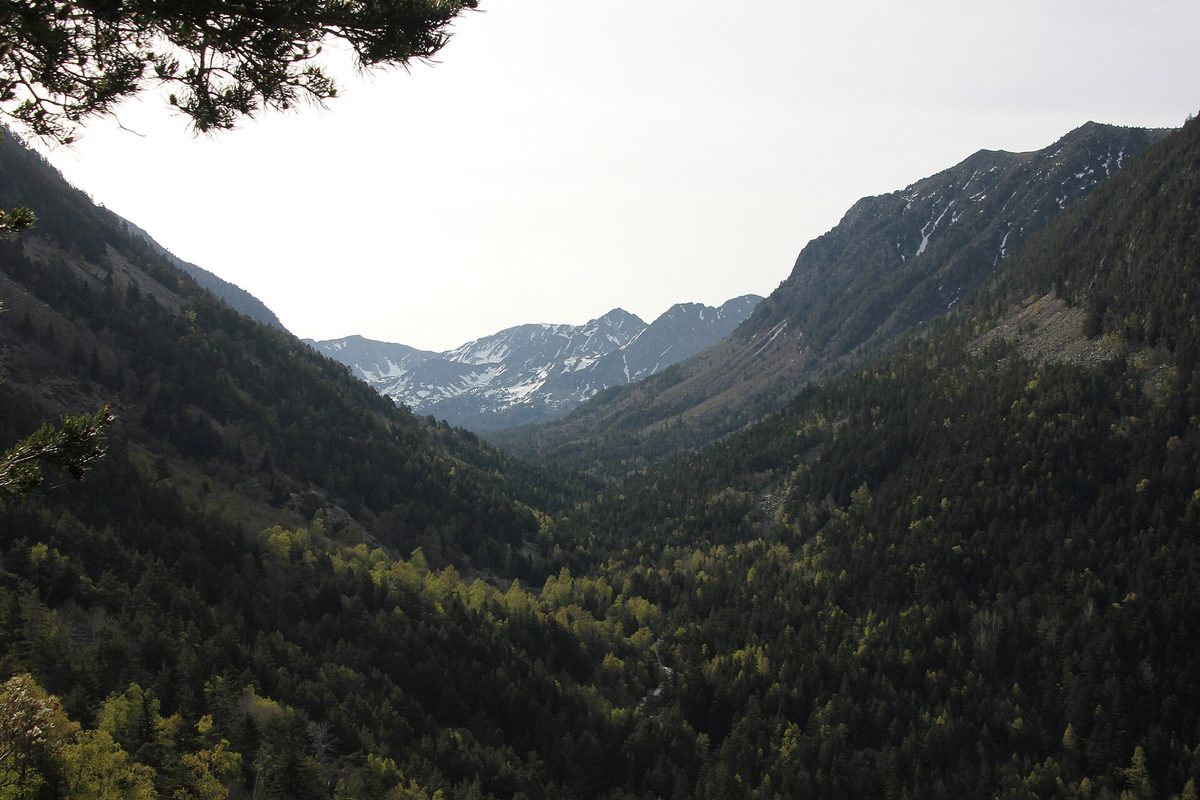
Sorteny: the wildflower valley
The Sorteny Valley Natural Park above Ordino is 1,080 hectares of the gentlest high-mountain scenery in the country, and from late June through July it stages the best wildflower show in the Pyrenees — the park counts more than 700 plant species, around 50 of them Pyrenean endemics, and concentrates a sampler of them in a small botanical garden near the entrance, sorted by habitat. (The whole parish of Ordino has been a UNESCO Biosphere Reserve since 2020, with the park as its core.) An easy 1.5–2 hour loop links the garden, the meadows and the staffed Borda de Sorteny refuge, whose kitchen takes the concept of “mountain hut food” personally — book a table on summer weekends. Harder walkers use Sorteny as the gateway to Estanyó (above) or the full ridge circuits; families can simply graze the lower paths and produce an indecent number of photographs. If you’re in Andorra primarily for general sightseeing rather than summit-bagging, this is the one mountain valley I’d insist you see anyway.

Multi-day: Coronallacs, the GRP and the hut system
Andorra’s hut network is the country’s best-kept secret. There are about 30 mountain refuges scattered across the high valleys; most are simple unstaffed stone cabanes — free, unlocked, first-come — and four are staffed in season with bunks, showers, dinner and wine: Comapedrosa (2,260 m), Juclar (on the big lake), L’Illa (above the Madriu) and Borda de Sorteny. Those four are the skeleton of the country’s flagship trek.
The Coronallacs
92 km, five stages of 13 to 22 km (average 18.4 km), 6,868 m of total climbing, sleeping one night in each staffed refuge on half board. You start and finish at the Escaldes-Engordany tourist office, where they issue the route passport you stamp hut by hut. It is — let’s be plain — a hard trek: stage after stage puts 1,300+ m of climbing into your day, and there’s no transport bail-out from the high sections. But the design is brilliant: you carry a light pack because dinner and bed are guaranteed, the route strings together most of the lakes in this article plus dozens you’ve never heard of, and in five days you cross effectively every landscape the country owns. People fly to New Zealand for less. Book the huts well ahead for July and August.
The GRP: the lap of the country
The GRP (“la volta a tot un país” — the tour of a whole country) is the Coronallacs’ older, wilder sibling: roughly 115 km and not far off 9,000 m of climbing around Andorra’s entire mountain rim, waymarked red-and-yellow, traditionally started at Aixovall and walked anticlockwise in seven stages using a mix of staffed huts and free cabanes. It’s the one to choose if you prefer self-sufficiency and silence to half board and company. Strong trail-runners race the whole thing; mortals should budget a week. The cross-border Camí de la Transhumància from the Incles valley and the HRP (the high Pyrenean traverse, which barrels straight through Andorra) round out the long-distance menu — detailed stage-by-stage guides to the Coronallacs and the rest of this section are publishing on this site over the coming months.
When to go hiking in Andorra
The honest season for high routes is mid-June to mid-October, and the calendar matters more here than most guides admit. North-facing slopes and anything over 2,600 m hold snow into early July most years — I’ve kicked steps across old drifts below Coma Pedrosa’s ridge on the first of July while the valley below sat at 24°C. July and August bring reliable trail conditions, valley temperatures of 15–25°C, deliciously cool mornings at altitude — and the two standing hazards of a Pyrenean summer: crowds on the famous trails (solved by starting before 9:00) and afternoon thunderstorms (solved the same way; check meteo.ad each evening and be off ridges by mid-afternoon). September is the connoisseur’s month — stable air, empty trails, huts still open — and early October turns the birch and aspen gold while the first dustings whiten the tops. May and early June are for valley walks only, and glorious for them. The full month-by-month breakdown, including what the weather does to the rest of your trip, lives in the best-time-to-visit guide.
Trailheads without a car
Andorra’s national bus lines make this one of Europe’s easiest small countries to hike car-free — a sentence I couldn’t write about most of the Alps. From the central station in Andorra la Vella: L4 runs hourly up the eastern valley through Canillo and Soldeu to Pas de la Casa, serving the Camí del Gall, the Vall d’Incles stop (for Juclar and Cabana Sorda) and Grau Roig connections; L5 reaches La Massana and Arinsal for Coma Pedrosa; L6 works the Ordino valley for the Ruta del Ferro, Sorteny and (with a walk or taxi up to the Coll) Casamanya. Rides cost visitors a couple of euros a hop — residents travel free with a pass, one of those quietly civilised Andorran policies — and timetables live on bus.ad. The summer closures at Vall d’Incles and Arcalís, which read as nuisances if you came by car, are non-events by bus. For arrivals, connections from Barcelona and Toulouse are covered in the getting-here guide; once you’re in the country the car is optional for everything in this article except the Madriu parking and Grau Roig at awkward hours.
What to pack, and how not to need rescuing
Andorra’s trails are well-marked (yellow dots for local paths, red-yellow for the GRP, signposts at most junctions with honest time estimates), but the altitude is real and the weather is properly alpine. The kit list that covers every day-hike here: proper hiking shoes or boots (the scree on the big peaks eats trainers), a windproof and a real waterproof even under blue skies, a warm layer year-round (summit wind chill at 2,900 m is a different season from the valley), sun cream and a hat (high-altitude sun plus 80 lakes’ worth of reflection), more water than feels necessary — two litres minimum on the long routes, since streams run through grazing land — and a charged phone. The emergency number is 112, mountain rescue is professional and helicopter-equipped, and coverage is surprisingly good except deep in the Madriu, which is half the point of the Madriu. Check meteo.ad (the national forecast, with altitude-specific bulletins) every evening, distrust any afternoon that starts too blue in July, and tell someone your route if you’re walking the lonelier valleys like Angonella. None of this is dramatic; the hills here are friendly. They just assume you’ve turned up dressed for them.
One rules note: wild camping is restricted in Andorra. The tolerated practice is a high-mountain bivouac — tent up at dusk, down at dawn, far from roads and never inside the parks’ restricted zones — and the free cabanes exist precisely so you don’t have to. Use them, leave them cleaner than found, and the system keeps working. Dogs are welcome on most trails (leashed in the nature parks) but not on the Incles electric train, a rule that has stranded more than one spaniel.

Where hikers should stay
The short version: base in Andorra la Vella/Escaldes for bus access to every valley and the widest restaurant choice; in Ordino or La Massana for the prettiest villages and the western parks on your doorstep; in Soldeu/El Tarter or Canillo for the eastern lakes and the Incles valley; skip Pas de la Casa entirely in summer, when it mostly hibernates. Hotel prices in July run 30–50% below ski-season rates, which makes summer hiking weeks here startlingly good value — the same spa hotel often asks barely half its February rate in July, and your legs will thank you for the spa. The full base-by-base comparison, with specific hotels at each price point, is in the where-to-stay guide; and if your party splits between hikers and shoppers, the capital keeps the non-walkers happy with the duty-free circuit while you’re up a mountain.
FAQ: hiking in Andorra
Is Andorra good for hiking?
Exceptionally, and it’s still under-visited compared with the Alps or even the Spanish Pyrenees. You get three nature parks, a UNESCO valley, 80-plus glacial lakes and seven 2,900 m summits inside 468 km², with staffed huts, marked trails and buses to most trailheads. The infrastructure is Swiss-grade; the crowds (mostly) aren’t.
What is the best hike in Andorra?
For most visitors, the Tristaina lakes loop — three glacial lakes for 4.4 km of easy walking. The best hard day is Coma Pedrosa, the country’s 2,942 m high point. The best long route is the five-day, 92 km Coronallacs. If forced to pick one walk to convert a sceptic, I’d choose the Vall d’Incles with the climb to the Juclar lakes.
How hard is Coma Pedrosa?
A serious but non-technical mountain day: 13.7 km round trip from Arinsal, about 1,400 m of climbing, six to eight hours, with an easy scramble on the summit ridge. Fit, properly-shod hikers manage it comfortably from late June once the snow has gone; it is not a first-ever mountain walk, and not advisable in storms or early-season snow.
Can you hike in Andorra without a car?
Yes — more easily than almost anywhere in the Pyrenees. Buses L4, L5 and L6 from Andorra la Vella reach the trailheads for the Incles valley, Juclar, Cabana Sorda, Coma Pedrosa, the Ruta del Ferro and Sorteny for a couple of euros a ride; the Camí del Gall and the capital’s own mirador circuits start from bus stops. Only the Madriu parking and a few road-pass starts like Coll d’Ordino are awkward without wheels.
When is the best time to hike in Andorra?
Mid-June to mid-October for the high routes, with snow lingering above 2,600 m into early July most years. July and August are warmest and busiest, with afternoon storm risk; September is the sweet spot of stable weather and empty trails; early October adds autumn colour. Valley walks are good from May.
Can you wild camp in Andorra?
Free camping is restricted. The tolerated practice is a discreet dusk-to-dawn bivouac in the high mountains away from roads and outside the parks’ restricted zones — and the network of free, unlocked stone cabanes plus four staffed refuges makes a tent optional for almost any route, including multi-day ones.
What is the Coronallacs and how long does it take?
Andorra’s flagship hut-to-hut trek: a 92 km circuit in five stages linking the four staffed refuges (Comapedrosa, Juclar, L’Illa, Borda de Sorteny) with 6,868 m of climbing, walked on half board with a stamped route passport from the Escaldes-Engordany tourist office. It’s demanding — 18 km of mountain per day on average — and worth every step.
Do you need a guide to hike in Andorra?
Not for anything in this article in summer conditions — trails are marked, mapped and busy enough. A local guide earns their fee for early-season snow, the Coma Pedrosa–Medacorba traverse, winter snowshoe routes, or if you simply want the flora and the smuggling stories narrated properly. The tourist offices keep lists of certified guides.
The bottom line
Andorra is the only country I know where you can finish breakfast in a capital city, be standing above three glacial lakes before noon, eat a hut lunch at 2,300 m, and still make a spa and a duty-free electronics run before dinner — a combination that sounds like satire and works like clockwork. The skiing made this country famous, and fair enough; that guide is the other half of this site for a reason. But summer is when Andorra is most itself: the 90% of the country that isn’t shops or pistes, open for walking, absurdly compact, honestly priced and still strangely overlooked. Start with Tristaina, graduate to Coma Pedrosa, give the Madriu a full day, and book the Coronallacs before the rest of Europe works out what’s hiding up here. Detailed trail-by-trail guides to every hike named above — Coma Pedrosa, the Madriu, Engolasters, the Incles valley, Tristaina, Sorteny, the easy-hikes shortlist, the Coronallacs and the nature parks compared — are publishing on this site through the summer, and this page will link to each as it goes live.
Photo credits
All photographs are from Wikimedia Commons under their stated licences, with thanks to the photographers:
- Photo: JMiall, CC BY-SA 3.0, via Wikimedia Commons — source
- Photo: Josemanuel, CC BY-SA 2.5, via Wikimedia Commons — source
- Photo: Ferran Llorens, CC BY-SA 2.0, via Wikimedia Commons — source
- Photo: AndyScott, CC BY-SA 4.0, via Wikimedia Commons — source
- Photo: Occitandu34, Public domain, via Wikimedia Commons — source
- Photo: Austral Lights, CC BY-SA 4.0, via Wikimedia Commons — source