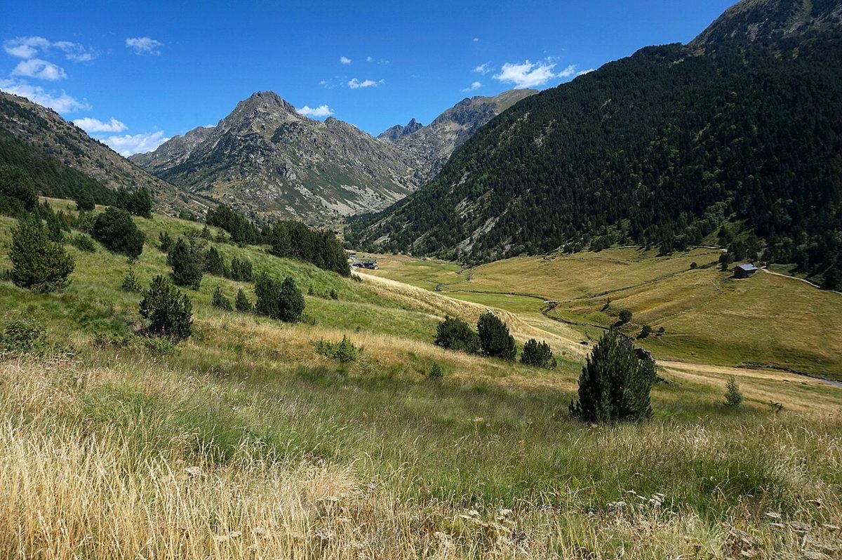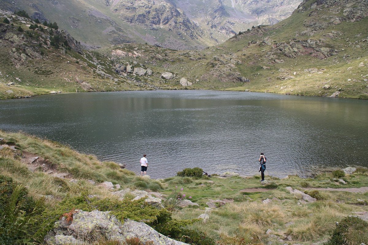
I have walked up to the Tristaina lakes four times now, and the moment never gets old: you grind up a stony path behind a mountain restaurant, put a hand on a chain for one short scrambly bit, top out on a rise, and the whole cirque drops open in front of you. Three lakes stacked up a hanging valley, a horseshoe of grey peaks behind them, and a metal ring balanced on the skyline like something left behind by a tidier civilisation. It takes about forty minutes to earn that view. That ratio of effort to payoff is close to unbeatable in the Pyrenees.
The Tristaina lakes hike is a 4.4 km circular walk at the top of the Ordino-Arcalis valley in northern Andorra, linking three glacial lakes at 2,200-2,330 m with roughly 200 m of ascent and descent. Most people finish it in two to three hours. This guide is for anyone who wants the route in detail, honest difficulty, and the transport rules that catch drivers out.
Last updated: September 2026. Lift calendars, road access rules and bus timetables in Andorra change every season, and I have hedged prices as “around” throughout. Check the Ordino-Arcalis site and the official bus timetables before you go.
Tristaina lakes at a glance
| Detail | What to expect |
|---|---|
| Distance | About 4.4 km for the classic circuit of the three lakes (official figure 4.39 km) |
| Ascent and descent | Around 200-215 m, spread over constant small ups and downs rather than one climb |
| Time | Two hours if you keep moving, three if you stop and look, which you will |
| Altitude | Start around 2,150 m, high point 2,330 m at Estany de Mes Amunt |
| Difficulty | Officially moderate. Realistically easy walking with one short chained scramble and a lot of loose rock |
| Trailhead | The La Coma car park and Borda de la Coma restaurant, inside the Ordino-Arcalis resort, Ordino parish |
| Season | Late June to late September is the safe window. Snow lingers on the upper section into mid-June |
| Lift pass | Around EUR 20-23 for the gondola plus Creussans chairlift day pass in 2026 |
| Signposting | Excellent. This is one of the few Andorran routes where you genuinely do not need a map |
| Best for | Families with school-age kids, first-time Pyrenean walkers, photographers, anyone with half a day |
Why this is the walk I recommend first
Andorra has harder walks, longer walks and lonelier walks. It does not have a better introduction to what the country actually looks like above 2,000 metres.
Most visitors arrive with a mental image of Andorra built from duty-free adverts and ski brochures, and then spend two days in a valley of concrete and perfume shops wondering where the mountains went. An hour and a quarter after leaving the capital, you can be standing at Estany del Mig with marmots shrieking at you from the scree. The contrast is the point. If you only do one walk on your trip, and you are not a serious hiker, do this one.
It also sits inside a landscape with some official weight behind it. The Ordino parish was designated a UNESCO Biosphere Reserve in October 2020, and the Tristaina cirque is the poster image for that designation. There is a reason every tourist-board photograph of Andorra in summer seems to be taken from the same rise above Estany Primer.
The honest caveat: it is popular. On a July Sunday you will share the path, especially the first kilometre from the car park. Go on a weekday, go early, or go in the last week of September when the crowds thin and the grass turns copper.
The three Tristaina lakes, one by one
The Catalan names tell you the geography before you even set off. Estany Primer is the first lake, Estany del Mig is the middle one, and Estany de Mes Amunt is the one furthest up. They are stepped up the valley in that order, each in its own scoop of rock left behind when the glacier pulled out.
Estany Primer
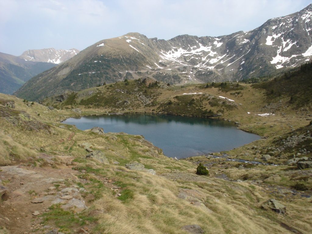
The smallest of the three and, to my eye, the most photogenic. It holds a deep, saturated blue that the other two never quite manage, and it is the one you meet first coming over the rise from the Creussans junction. About forty minutes from the car park at a gentle pace.
Two paths run along each side of it, a high one and a low one. Take the high path if the water is up. Early in the season, when the snowmelt is still pouring in, the low path can be under a few centimetres of water and you will end up with wet boots for no good reason.
If you have small children and a limited appetite for the rest of the loop, this is a perfectly respectable turnaround point. You have seen a proper glacial lake, you have the cirque above you, and nobody is going to think less of you.
Estany del Mig
Cross the wooden footbridge at the eastern end of Estany Primer, follow the shoreline, climb a low grassy hill, and the middle lake appears. This one is hemmed in by scree slopes running down from the ridge, and it feels noticeably more severe than the first.
Above it, tucked in a shallow shelf in the cirque wall, sits Llacuna Superior. It is barely more than a pond and it is reached by a side trail of roughly 400 metres. Worth it if you have the time and the snow has gone. Skip it in June, when that shelf holds snow long after the main circuit has cleared.
Estany de Mes Amunt
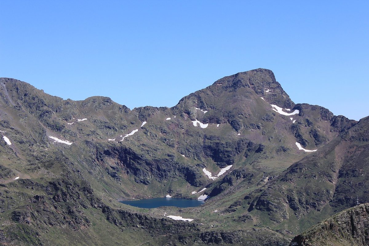
The largest of the three, nearly circular, and the high point of the walk at around 2,330 metres. It sits directly beneath Pic de Tristaina, which tops out at 2,878 m, and on a still morning the reflection is absurd.
Swimming is permitted here in summer, and people do it. I have done it exactly once. The water in a high Pyrenean lake sits at a handful of degrees even in August, and the experience is less “refreshing dip” and more “involuntary shriek followed by a very fast exit”. Take a towel and manage your expectations.
From the southern shore you cross another footbridge, turn left, and follow a narrow trail hugging the outflow stream back down to Estany del Mig. That is the loop closing.
Walking the route, step by step
Here is the circuit as I would describe it to a friend on the phone.
From Borda de la Coma to the Creussans junction
Behind the restaurant at La Coma, a wide path swings right and starts climbing steadily. It is stony, it is exposed, and on a hot afternoon it is the least enjoyable twenty minutes of the day. Do it in the cool of the morning if you can.
Partway up there is one short section of easy rock scrambling with fixed chains for support. You will use your hands. It is not exposed and it is not dangerous in dry conditions, but it does mean this is not a buggy route and it is not a route for anyone unsteady on their feet. Children who can walk confidently on uneven ground handle it fine; I have watched six-year-olds treat it as the highlight.
The path tops out at what everyone calls the Creussans junction, a signposted hillside intersection with the whole cirque laid out below. This is the money shot. Most people stop here for ten minutes whether they meant to or not.
Anticlockwise or clockwise?
From the junction, head right and down to Estany Primer, then work your way up the valley to the top lake, and return along the length of Estany del Mig to the junction. That is the standard direction and it is the one I would take.
Going the other way works perfectly well, but you arrive at Estany Primer at the end when the light is flatter and your legs are done, and Estany Primer deserves better than that.
Around the lakes
Once you are on the plateau the walking is genuinely easy. Braided streams, marsh grass, boulder fields, the occasional patch of old snow well into July. The path is worn and obvious and marked at every junction.
Keep an eye out for the free-roaming Percheron horses that graze this valley in summer. They are large, unbothered and entirely used to walkers. Stoats live in the boulder fields, marmots whistle from the scree, and if you look down rather than up you will find alpine specialists like rock jasmine flowering in the cracks.
Back down to the car park
From the Creussans junction it is a straightforward twenty to twenty-five minutes back down the way you came, chains and all. Descending the chained section is marginally more awkward than climbing it. Take your time and use the cable.
There is an alternative descent from Estany Primer down to the valley floor and the lower car parks, which I cover below under transport, and which matters a great deal if the road above is closed to cars when you visit.
Making a full day of it
The classic loop is short. If you have driven forty-five minutes to get here, you may want more, and there is plenty available. These extensions are exactly why the Tristaina lakes work as a half-day rather than a quick photo stop.
The solar viewpoint
The metal ring you can see on the skyline is the Mirador del Solar, a 25-metre suspended platform and working sundial perched at 2,701 m on the summit of Punta de Peiraguils. It is the single best thing in the area and it deserves its own visit. I have written up the structure, the access rules and the sundial mechanics in detail in the guide to the Tristaina solar viewpoint.
Three walking routes reach it. The easiest follows the steep gravel service road beneath the Creussans chairlift from behind the restaurant, about 2.5 km with roughly 446 m of climbing, joining a ridge path with a short cabled section at the end. The hardest climbs directly from the Creussans junction up the cirque wall to the Port de Tristaina saddle, then along the ridge. A middle option leaves the junction, curls around Roc del Vaquer and joins the service road.
Combining the lakes circuit with the viewpoint gives you roughly 10 km and around 730 m of ascent, which is a solid four-hour day. If the climbing does not appeal, the Creussans chairlift takes you most of the way for the price of a lift pass, and there is no shame whatsoever in that.
Estany de Creussans
A fourth lake, smaller and quieter than the famous three, sitting off the service road on the way to the viewpoint. It is a short detour and it is usually empty. If you want ten minutes of silence after the busy main circuit, this is where to find it.
Coming up from El Serrat on foot
Without a car, and without a lift ticket, you can walk the whole thing from the village of El Serrat. From the Les Subiranes bus stop you drop down past the hotel, cross the road onto the Cami d’Encodina, and climb gradually alongside the Riu Tristaina to the cable-car station and beyond.
It adds around 5 km each way. Done as a full circuit including the solar viewpoint it comes out near 18.8 km with about 1,330 m of ascent, which is an eight-hour day and a genuinely serious one. The lower half is functional rather than beautiful, mostly gravel and asphalt with little shade, and the walking only gets good in the meadows below the lake plateau. Bring more water than you think.
Getting to the trailhead
This is where people come unstuck, so read this section properly. The transport rules at Arcalis in summer are not obvious and they change.
By car
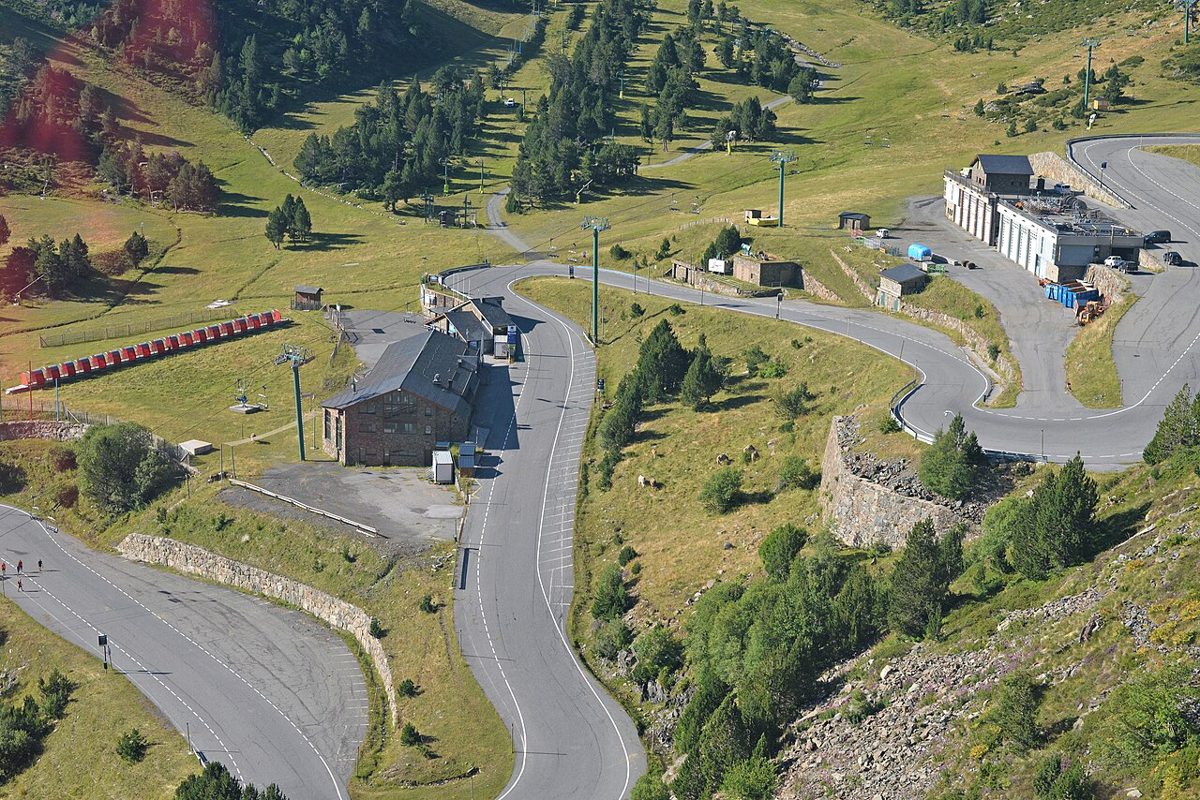
From Andorra la Vella it is around 45 minutes up the CG3 through Ordino, La Cortinada and El Serrat, then a long series of switchbacks into the resort. It is a fine drive and an easy one by Andorran standards, though the last stretch is narrow. Anyone nervous about mountain roads should read our notes on driving to Andorra before setting off.
The complication: in peak summer, the final couple of kilometres of road up to La Coma are restricted to reduce congestion on the switchbacks. Accounts of the exact rule differ. One widely repeated version allows cars up only before around 8:30am and after around 5:30pm; the tourist board describes the upper road as reserved for cyclists during the summer months, with the cable car as the alternative. What is consistent is that you cannot simply drive to the top at 11am in August.
Assume you will park at the large lower car park opposite the Tristaina cable-car station and go up from there. If that is the case you have two options: walk the 2 km of road up to the restaurant, or, much better, take the marked trail that passes the small dam and climbs directly to Estany Primer, joining the circuit from below. Same distance, infinitely nicer. Check the current access rules with the resort the week you travel.
By lift
The Tristaina gondola runs 1,600 m from the L’Hortell sector up to La Coma in about ten minutes. Twenty cabins, six of them with glass floors, which children find either thrilling or appalling. From the top station you walk straight onto the circuit.
For summer 2026 the gondola was scheduled to run 8:30am to 5pm: weekends from 6 to 19 June, daily from 20 June to 13 September, then weekends only from 14 September to 1 November, plus a few public holidays. The Creussans chairlift ran daily from 6 June to 1 November, 8:45am to 5pm, with last ascent around 3:30pm and last descent around 4:40pm. Those last-lift times matter more than people expect. Note them down.
The combined summer pass covering both lifts was around EUR 20 in low season and EUR 23 in high season, with high season counted as weekends, public holidays and the stretch from 20 June to 14 September. Under-fives went free, and there were discounts of around 15% for families and over-65s. In low season the pass covers only the chairlift. Prices move each year, so treat these as a guide rather than gospel. There is more on the resort itself in our Ordino-Arcalis guide.
By bus
No public bus goes to the trailhead in summer. This surprises people, because the L6 timetable shows a service continuing from Ordino up to Arcalis, but that extension runs in the ski season only.
What works: take the L6 from the national bus station in Andorra la Vella to Ordino, riding to the last stop. From the El Raval stop on the main road, the Ordino community bus continues to Les Subiranes in El Serrat roughly every half hour on weekdays. Weekends are thinner, and at times the buses only reach Ordino. From El Serrat you are walking.
Fares are cheap. Urban buses were around EUR 1.90 a trip and the community buses a token amount, paid in cash on board. Avoid the 8-9am weekday services if you can, since they double as school buses and are packed. Our guide to getting around Andorra covers passes and route numbers in more detail.
Blunt assessment: if you do not have a car, the lakes are awkward but not impossible. Budget a full day, start early, and accept that you are doing a long approach walk rather than a short lake circuit.
When to go
The season
Andorran mountain safety advice is to keep to routes above 1,700 m between late June and the end of September, and for this walk that is sound. The circuit tops out at 2,330 m in a north-facing cirque, which is about as slow to clear as terrain gets in this country.
Late May and early June: expect snow across the upper half. The path between Estany del Mig and Estany de Mes Amunt holds it longest, along with the side trail to Llacuna Superior. Walkable with care in good boots, unpleasant in trainers, genuinely risky if a hard overnight freeze has turned the snow to ice.
Late June through July: full flow. Waterfalls thundering, meadows in flower, streams running high enough that some crossings need thought.
August: the busiest month and the warmest. Good conditions, hot on the ascent, more people than you probably want. If you are travelling then, our notes on Andorra in August are worth a read for crowd timing.
September and October: my favourite. Stable weather, thin crowds, low sun, and the valley grass turning gold and rust. The gondola drops to weekends only from mid-September, so check before relying on it.
Winter: the lakes freeze and the whole area becomes ski terrain. The summer circuit is not a winter walk. Snowshoeing here is a guided activity, not a casual one.
Time of day
Start before 9am. Two reasons. First, Pyrenean afternoons in July and August build cloud fast and thunderstorms are common from early afternoon; being on an exposed 2,300 m plateau when one arrives is not where you want to be. Second, the light on the lakes is better and the car parks are emptier.
If the road access window is in force, an early start is not optional anyway.
What to bring
- Proper walking shoes or boots with grip. The loose rock on the climb punishes flat-soled trainers.
- More water than the distance suggests. There is no shade for most of the circuit and altitude dries you out.
- A windproof layer. It can be twenty degrees in the car park and distinctly cold on the plateau in a breeze.
- Sun protection, seriously. The UV at 2,300 m is fierce and the reflection off snow patches and water compounds it.
- Poles if you have dodgy knees, particularly early in the season when there is snow to cross.
- Cash for the bus if you are not driving. Card payment on board is not reliable.
- A swimming towel if you fancy the lake. See earlier warning.
You do not need a map, a GPS device or a guide for the classic circuit. You do want at least one of those for the extended routes up to the ridge, where the paths are rougher and less obvious.
Who this walk suits, and who it does not
Families with children who can walk a few kilometres on rough ground: yes, enthusiastically. The forty-minute stretch from the car park to the first lake is the perfect first mountain outing, and there are constant distractions in the shape of horses, marmots and water. Our Andorra with kids guide has more on pacing family days here.
Anyone with a buggy or a wheelchair: no. The chained scramble rules it out, and the plateau paths are narrow and rocky.
Nervous or inexperienced walkers: yes, with the caveat that “moderate” on the Andorran scale means real mountain terrain. Take the walk seriously, take the weather seriously, and you will be fine.
Serious hillwalkers: the classic loop alone will feel short. Add the viewpoint circuit via Port de Tristaina, or use this as a warm-up before something bigger. For a proper day out, look at Coma Pedrosa, the country’s highest peak.
Mistakes I see people make
Turning up mid-morning in August and discovering the road is shut. It happens constantly. The car park below fills, tempers fray, and people give up entirely rather than walk the extra 2 km.
Doing only the first lake because they assumed the loop was long. It is 4.4 km. Estany de Mes Amunt is twenty-five minutes further on and it is the best of the three.
Skipping the solar viewpoint because the walk up looks steep. If the climb puts you off, take the chairlift. Coming all this way and not going up is the real error.
Wearing trainers in June. The snow patches on the upper section are not deep, but they are firm, angled and slippery in smooth soles.
Underestimating the last-lift times. Miss the 4:40pm descent and you are walking down to the valley floor, which is a long, dull hour on tired legs.
How it compares to Andorra’s other lake walks
Andorra has more high lakes than a country of this size has any right to, and it is worth knowing where Tristaina sits among them.
The Juclar lakes above Vall d’Incles are wilder and considerably longer, with a proper climb to a refuge and no lift assistance. If Tristaina leaves you wanting more of the same, go there next.
Lake Engolasters is the opposite end of the scale: a reservoir at 1,600 m with a flat, easy loop, reachable in twenty minutes from Escaldes and ideal for an evening stroll rather than a hike.
The Madriu-Perafita-Claror valley, Andorra’s UNESCO World Heritage site, has its own scattering of small lakes and a completely different character. No lifts, no crowds, no infrastructure, and a real sense of remoteness. It is the one I would send experienced walkers to.
The full picture, including grading and season notes for every major route, is in our pillar guide to hiking in Andorra.
Where to base yourself
El Serrat is the closest village to the trailhead, a small cluster of buildings at the head of the valley with a handful of hotels. Staying there puts you twenty minutes from the resort road and in the quietest corner of the country. It is also very quiet in the evening, which is either the appeal or the drawback depending on your temperament.
Ordino, La Cortinada and the string of hamlets between them offer more choice and more life while keeping you close. Ordino in particular is one of the more attractive spots in the country, and it features in our round-up of Andorra’s villages.
Most visitors base themselves in Andorra la Vella or Escaldes-Engordany for the shops, restaurants and bus links, and drive up for the day. That works: 45 minutes each way is nothing. Our guide to where to stay in Andorra weighs up the trade-offs by parish, and there are campsites in the northern valleys if you would rather sleep outdoors.
Frequently asked questions about the Tristaina lakes hike
How long does the Tristaina lakes hike take?
The classic circuit of the three lakes is about 4.4 km and takes two to three hours at a normal walking pace, including stops. Reaching the first lake alone takes roughly forty minutes from the La Coma car park. Add the solar viewpoint and you are looking at around four hours and 10 km in total.
Is the Estanys de Tristaina walk difficult?
It is graded moderate and I would call it easy-to-moderate in dry summer conditions. Total ascent is only around 200 m, but it comes in constant small rises rather than one climb, and there is a short chained scramble on the way up from the restaurant. Loose rock and altitude are the main challenges, not steepness.
Can you swim in the Tristaina lakes?
Yes, swimming is permitted at Estany de Mes Amunt in summer, and it is the only one of the three where bathing is signposted as allowed. The water sits at just a few degrees even in August, so plan for a very short dip. Bring a towel and dry layers, and do not swim alone.
Can you drive to the Tristaina lakes?
You can drive to the La Coma car park in the Ordino-Arcalis resort outside peak summer, and walk from there. During the busiest summer period the top section of road is restricted, often to a window early in the morning and late in the afternoon. Check the resort’s current access rules before setting off.
Do you need a lift pass for the Tristaina lakes?
No. The walking is free and the trails are public. A summer lift pass, around EUR 20-23 in 2026, saves you the climb from the valley on the Tristaina gondola and gets you up the Creussans chairlift towards the solar viewpoint. If the road is open and you drive to La Coma, you can do the whole lakes circuit without paying anything.
What is the best time of year to hike Tristaina?
Late June to late September. July and August give the most reliable conditions and the biggest crowds; September brings quieter trails, stable weather and better colour. Before mid-June expect snow on the upper section, and check the gondola calendar from mid-September, when it usually drops to weekends only.
Are the Tristaina lakes suitable for children?
Yes, for children who can walk a couple of kilometres on uneven ground. The stretch from the car park to Estany Primer is a well-judged first mountain walk at about forty minutes each way. The chained scramble means no buggies, and the full loop is more than most under-sixes will manage happily.
How do you get to Tristaina without a car?
Take the L6 bus from Andorra la Vella to Ordino, then the community bus on to El Serrat, and walk the remaining 5 km or so up to the lakes. No summer bus reaches the trailhead itself. It makes for a long but rewarding full day, so start early and check the return timetable before you commit.
Related guides
If the lakes have you wanting more mountain time, start with the complete guide to hiking in Andorra, then look at our seasonal round-up of things to do in summer. For a sit-down view with no walking involved, the Roc del Quer viewpoint is twenty minutes from Ordino. Plan the timing of your trip with our notes on the best time to visit Andorra, and read the practical Andorra travel tips before you arrive.
Photo credits
All photographs are from Wikimedia Commons under their stated licences, with thanks to the photographers: