The question I get asked most often about walking in this country arrives in the same shape every time: “which national park should we do?” And every time I have to give the slightly deflating answer first, because the premise is wrong. Andorra does not have one. What it has instead is arguably better, and definitely stranger.
There is no Andorra national park in the legal sense. The country protects three areas as nature parks: Sorteny Valley, Comapedrosa and the Vall del Madriu-Perafita-Claror, which is also a UNESCO World Heritage Site. This guide explains the difference, then compares all three so you can pick the right one for your legs and your days.
Last updated: September 2026. Refuge opening dates, bus timetables and park rules change from season to season — I have hedged the numbers where I am not certain, and you should check the official park sites before you set off.
Andorra’s protected areas at a glance
| Detail | What you need to know |
|---|---|
| National parks | None. Andorra has no IUCN-style national park and never has. |
| Nature parks | Three: Sorteny Valley (Ordino), Valls del Comapedrosa (La Massana), Vall del Madriu-Perafita-Claror (four southern parishes) |
| UNESCO status | Only Madriu-Perafita-Claror, inscribed in 2004 as a cultural landscape, with a small extension in 2006 |
| Sizes | Sorteny around 1,080 ha; Comapedrosa 15.42 km²; Madriu-Perafita-Claror 42.47 km², roughly 9-10% of the whole country |
| Highest point | Pic del Comapedrosa, 2,942 m — the summit of Andorra, inside Comapedrosa park |
| Entry cost | Free. You pay for parking in a few spots, and for refuge beds and meals. Nothing else. |
| Best all-round season | Mid-June to mid-October. July and August for flowers, late September for colour and empty paths. |
| Easiest to reach | Sorteny, from El Serrat in Ordino. Hardest is Madriu — every entrance involves a real climb. |
| Vehicles | Madriu-Perafita-Claror is entirely pedestrian. No cars, no road, no plans to build one. |
Why there is no Andorra national park, and why it barely matters
Andorra is 468 square kilometres of mountain wedged between France and Spain. Almost all of it is above 1,000 metres. In a country that small and that vertical, a national park in the American or Spanish sense, meaning a large state-owned reserve with gates, rangers and an entrance fee, would swallow a serious slice of the territory and step on centuries of communal land rights.
So the Andorrans did something else. Land here has been owned and grazed collectively by the parishes, the comuns, since the Middle Ages. Protection was layered on top of that existing system rather than replacing it. Two of the three parks are communal nature parks, run by the parish that has always owned the ground.
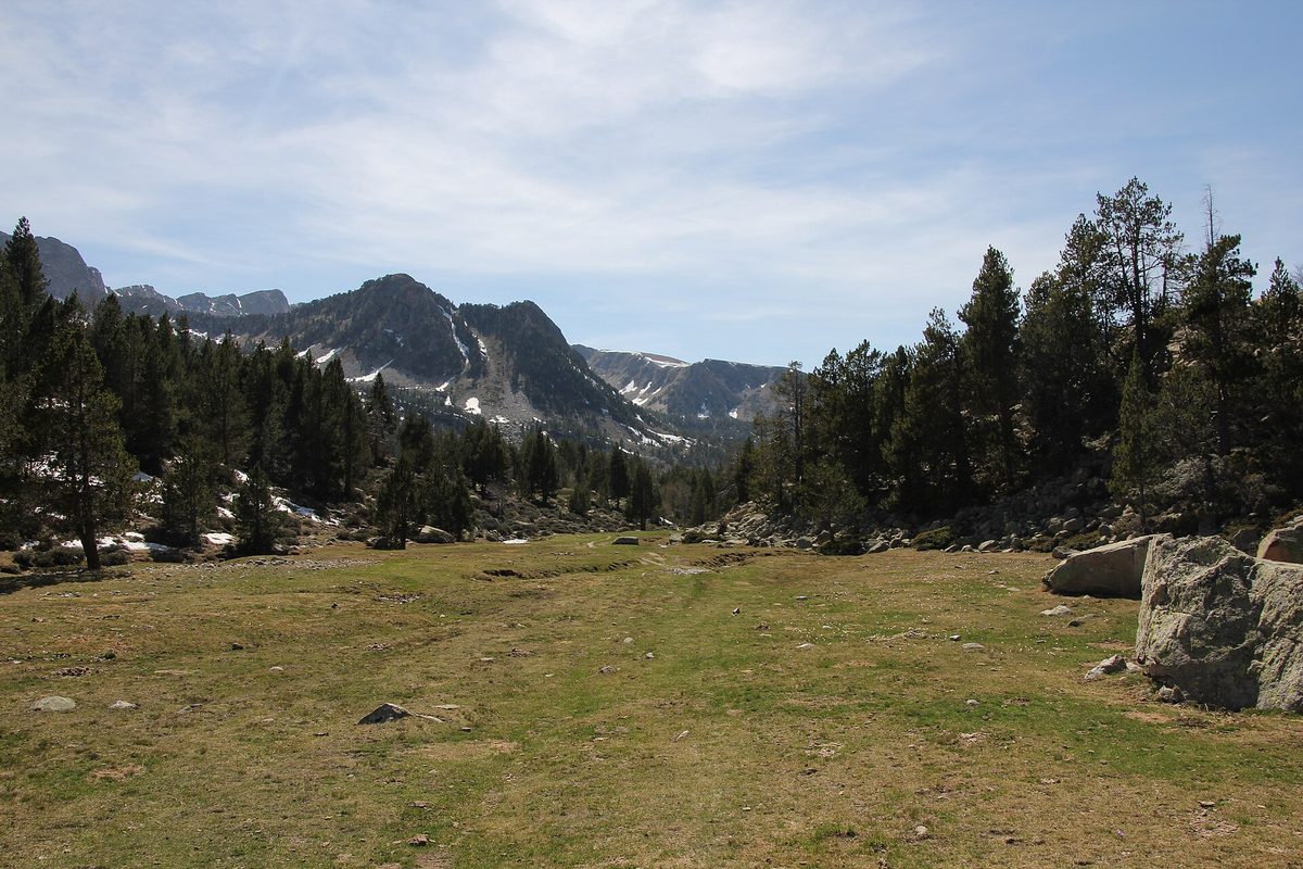
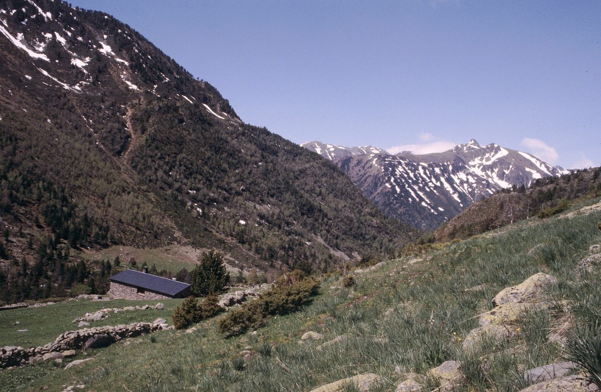
The practical result for you as a walker is that these places feel lived-in rather than fenced off. You will meet cattle. You will walk past stone huts that shepherds still use in summer. Nobody checks your ticket, because there isn’t one.
What “nature park” actually means on the ground
A parc natural here means the area has a management plan, a warden service of sorts, marked and maintained paths, and restrictions on building, camping, fires and motor vehicles. It does not mean a visitor complex with a gift shop.
Sorteny and Comapedrosa both have small information points. Comapedrosa’s is in Arinsal, Sorteny’s sits by the car park at the valley entrance. Madriu has a visitor centre in Escaldes-Engordany at Borda Gabriel on carrer de l’Obac. That is roughly the extent of the infrastructure. Do not expect a café at the trailhead.
Wild camping is restricted across all three. Bivouacking above a certain altitude for a single night, arriving late and leaving early, is generally tolerated in the Pyrenean tradition, but pitching a tent for a week on a lakeshore is not. If you want to sleep under canvas legally and comfortably, the campsites in Andorra are cheap and mostly in the valleys.
The UNESCO exception
Madriu-Perafita-Claror is the one that carries international status. It went onto the UNESCO World Heritage list in 2004, and it is still Andorra’s only entry. Crucially, it was listed as a cultural landscape, not a natural one. The citation is about 700-odd years of humans farming, smelting iron and grazing sheep in a high valley without wrecking it.
That distinction matters when you walk it. You are not looking at wilderness. You are looking at a landscape that people made and then, unusually, left alone. I have a longer piece on the Madriu-Perafita-Claror valley if you want the full route detail.
The bits that confuse people
Three other labels get thrown around and muddy the water.
The parish of Ordino was designated a UNESCO Biosphere Reserve in 2020, which covers the whole parish, not just Sorteny. The Parc Pirinenc de les Tres Nacions is a cross-border grouping that links Comapedrosa and Sorteny with the Alt Pirineu park in Catalonia and the Pyrénées Ariégeoises regional park in France — it is a cooperation framework, not a place you visit. Naturland, above Sant Julià de Lòria, is an adventure park with a toboggan run. Good fun with children, no relation to the protected areas.
The wording wobbles in translation too. Andorra natural parks, Andorra nature parks, communal natural parks, parcs naturals: they all point at the same three places. Catalan uses parc natural, and the English translations on official sites swap between “nature park” and “natural park” without any difference in meaning.
Tripadvisor and AllTrails both file Andorra’s parks under “national parks” because their software has a single category for the concept. Ignore the label; the trails underneath are real.
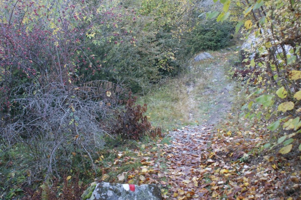
Vall del Madriu-Perafita-Claror: the big, quiet one
This is the one I would send a serious walker to, and the one I would gently steer a casual day-tripper away from.
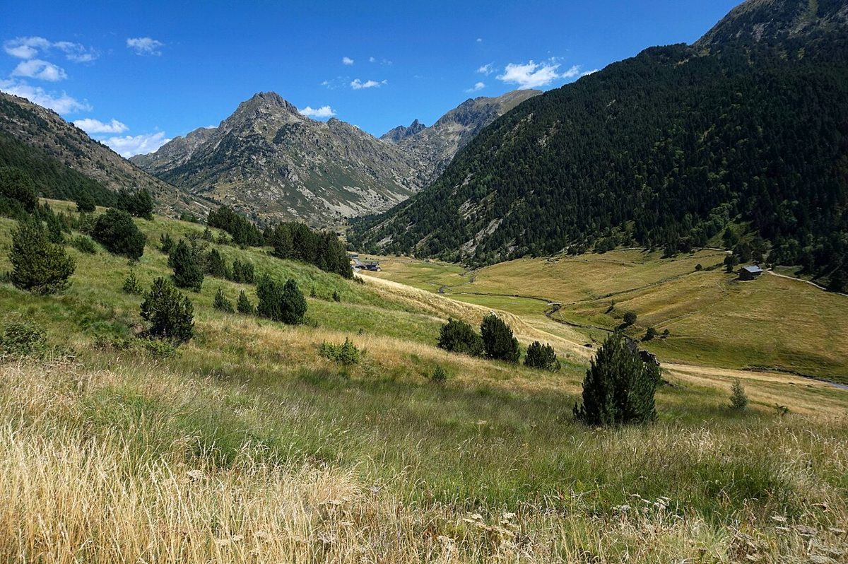
The valley runs east from above Escaldes-Engordany, deep into the southern mountains, bounded by ridges and by the Spanish border. It covers 42.47 square kilometres, close to a tenth of the country, and there is no road into any of it. Every single entrance is a climb on foot.
What you get for that effort is silence. On a Tuesday in September I walked from Escaldes up to Ramio and saw four people all morning, which in a country of eighty thousand with three million annual visitors still surprises me.
What it feels like
The lower valley is wooded and steep, pine and birch, with a river below you making a lot of noise. Then it opens out. Around Ramio and Entremesaigües there are twelve granite houses with schist roofs, terraced fields that grew rye until living memory, and drystone walls running up slopes at angles that look unreasonable.
Higher up it turns to open pasture, then to rock and lakes. Estany de l’Illa sits at the head of the valley below the Pessons ridge. The remains of a Catalan-style forge, abandoned in 1790, are down by the Madriu river if you know where to look — the interpretation panels help.
Getting in
There are more entrances than most guides admit. The four that matter:
- From Escaldes-Engordany, the Camí de Muntanya off the Plana road, or from the Circuit de les Fonts car park on the Engolasters road via Coll Jovell down to Ramio. This is the classic way in and the one I use.
- From Andorra la Vella, up the Comella road about 4 km to the picnic area, then the long haul to Refugi de Prat Primer and over into Claror. There is free parking at that trailhead.
- From Encamp, via Els Cortals or Grau Roig and the Pessons lakes, over Collada de Pessons to Refugi de l’Illa. This is the high back door.
- From Sant Julià de Lòria, via Naturland or the Rabassa area, entering over the southern ridges.
The Escaldes side is the most convenient if you are staying in the capital, and the Escaldes-Engordany approach also puts you within walking distance of a hot spring afterwards, which is not nothing after 900 metres of descent. If you are parking at the Engolasters end, you are also five minutes from Lake Engolasters, which makes a decent warm-up loop the day before.
Routes worth doing
The half-day version: park at Circuit de les Fonts, walk over Coll Jovell and down to Ramio, poke around the old houses, come back. Around 4-5 hours with stops, and a few hundred metres of ascent both ways because you drop into the valley and have to climb out again. People forget that bit.
The full day: Escaldes to Refugi de Fontverd and back, or push to Riu dels Orris. Long, around 8 hours, mostly gentle gradient once you are in the valley floor.
The overnight: up to Refugi de l’Illa at 2,480 m, Andorra’s highest staffed refuge, sleep, and come down the other side to Encamp. This is the one to do. Book the refuge — it has around 50 places and fills in August.
The GR7, GR11 and the GRP circuit of Andorra all pass through, and the valley forms a section of the Coronallacs trek, the five-day refuge-to-refuge circuit of the whole country.
Who should skip it
If you have half a day, no car and small children, this is the wrong park. There is no lift, no shortcut and no gentle entrance. The valley makes you earn every metre. Go to Sorteny instead.
Valls del Comapedrosa: the one with the summit
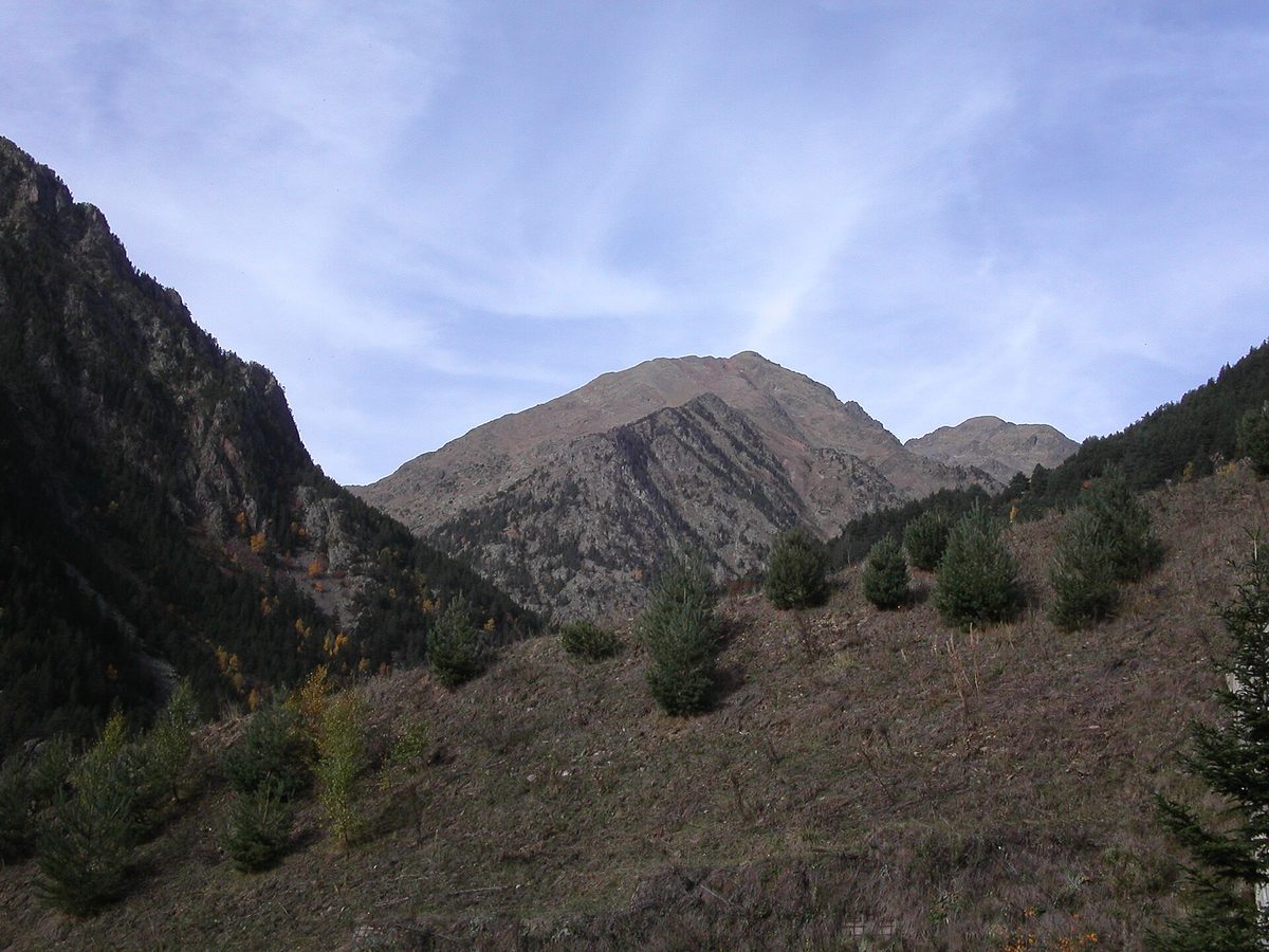
Comapedrosa is the smallest of the three in area, 15.42 square kilometres in the north-west corner above Arinsal, and the most dramatic per square kilometre. It contains the highest point in the country and a set of lakes that sit in proper granite bowls.
The park is run by the parish of La Massana. Its information point and interpretation centre are in Arinsal, which is also where you park, and which in summer is a strange, half-empty ski village with excellent value accommodation.
The Comapedrosa ascent, honestly
Everyone wants the summit. Here is what it involves.
You start from the car park at the top end of Arinsal, around 1,580 m, and finish at 2,942 m. That is roughly 1,350-1,400 metres of ascent, and most parties take 4 to 5 hours up and 3 down. Call it a full day, 8 hours car to car with breaks.
The first third is a pleasant graded path through forest on the GR11. At about 2,220 m you reach the Refugi de Comapedrosa and, a few minutes further, Estany de les Truites, a lake in a wide bowl that is where a lot of people sensibly stop.
Above the lake it changes character completely. The path climbs steeply over blocky granite and scree past Estany Negre, and the last section to the ridge is loose, tedious and unrelenting. There is no scrambling as such and no exposure that would frighten a hillwalker, but I have watched more than one person turn round in that scree, and there is no shame in it. In August I found it genuinely unpleasant in the afternoon heat; start early.
Storms build here from about 2pm in July and August, reliably. If you are not off the summit ridge by early afternoon in high summer, you have made a planning error. I go into the seasonal detail in the guide to climbing Coma Pedrosa.
Gentler options in the same park
You do not have to summit anything. Two good alternatives:
Walk only as far as the Refugi de Comapedrosa and Estany de les Truites and turn around. That is around 700 metres of ascent, 3-4 hours return, and you see the best of the high scenery. The refuge is staffed in summer and does food, which turns it into a proper day out.
Or do the park’s interpretive circuit lower down, which is signposted, gentle, and designed for families — there is a children’s activity built around it that the tourist office in La Massana can explain. The La Roca de la Sabina viewpoint, at roughly 1,900 m near the foot of the Arinsal slopes, gives you a big view for almost no effort. More of these are collected in my roundup of easy hikes in Andorra.
Rules that changed recently
In July 2026 the park brought in new measures protecting the lakes and regulating bicycle access. As I understand it, swimming in Estany Negre is now prohibited and bikes are restricted on certain routes. Check the park’s own site before you plan a ride or a swim, because these things get tightened rather than loosened.
The lifts at Pal Arinsal run in summer and can shorten some approaches on that side of the valley, though not the Comapedrosa route itself.
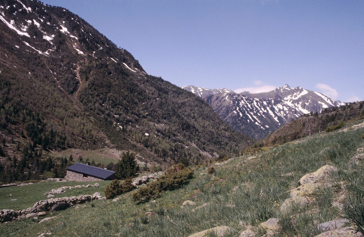
Sorteny Valley: the one for flowers and easy days
Sorteny is the smallest park, a shade over 1,000 hectares in the parish of Ordino above the village of El Serrat, and it is the one I recommend most often. Not because it is the most spectacular, but because the ratio of reward to effort is absurd.
It was Andorra’s first protected area, established in the 1990s, and it holds the richest plant life in the Pyrenees — figures of 700 to 800 species get quoted. The on-site botanical garden grows around 300 of them with labels, which is the only way most of us would ever tell a Pyrenean saxifrage from any other saxifrage.
The valley floor
You drive up the CG3 to El Serrat, then a short side track to the park car park at around 1,800 m. The information point there opens in summer and winter.
From the car park it is a walk of well under half an hour, almost flat, along the Sorteny river to the Refugi Borda de Sorteny at about 1,970 m. It is a staffed refuge with a restaurant serving Andorran mountain food, and it is one of the few places in the country where you can eat a proper meal without having climbed a thousand metres first.
Do that walk in early July and the meadows are absurd. I once had the whole valley to myself on a Tuesday morning in the first week of July, with the flowers at their peak and not another car in the park.
Going higher
If you want more, the valley is the gateway to two of the country’s better 2,900 m peaks: Pic de l’Estanyó at 2,915 m and Pic de la Serrera at 2,913 m. Both are long walks rather than climbs. Estany de l’Estanyó, at around 2,340 m, is a fine halfway target on its own — figure on 3-4 hours return from the refuge area.
Sorteny also links into the wider Ordino high country. Drive fifteen minutes further up the road and you are at Ordino-Arcalís, from where the Tristaina lakes circuit is a short, high, extremely photogenic loop.
Why I send families here
Flat approach, short distance to a refuge with food and a toilet, wildlife you have a genuine chance of seeing (Pyrenean chamois on the slopes, marmots whistling, newts and frogs in the wet ground), and a botanical garden that turns a walk into a scavenger hunt. If a park visit has to work for a seven-year-old, this is the one.
So which Andorra nature park should you hike?
Here is how I actually decide when someone asks.
If you have one day and no car
Sorteny. Bus line L6 runs from Andorra la Vella up to Ordino, and Ordino’s local parish services continue towards El Serrat and Sorteny for a token fare — around twenty cents last I looked. Check current timetables at bus.ad, because the parish loops are seasonal and infrequent. Getting to Arinsal by bus is doable too; getting into Madriu without a car means starting from Escaldes on foot, which adds a stiff climb before you have even entered the park. My guide to getting around Andorra covers the bus network properly.
If you want the hardest thing
Comapedrosa summit, obviously. If you have done it, or the weather closes the tops, the Madriu traverse from Escaldes to Encamp over Refugi de l’Illa is a bigger day in every sense except altitude.
If you are walking with children
Sorteny first, Comapedrosa’s interpretive circuit second. Madriu third and only for teenagers who like walking.
If you want to sleep out
Madriu, without hesitation. Refugi de l’Illa at 2,480 m is the highest staffed refuge in the country and one of the best nights you can have in the eastern Pyrenees. Comapedrosa’s refuge at 2,220 m is the runner-up and easier to reach.
If you want scenery for minimal effort
None of the three, honestly — go to the Tristaina lakes above Ordino-Arcalís, or up Vall d’Incles towards the Juclar lakes. Both give you high-mountain views with a fraction of the work, and neither is inside a protected park.
If you only have half a day
Sorteny valley floor, or the Comapedrosa viewpoint circuit. Do not start Madriu with half a day. You will get an hour in, realise the scale of it, and turn round frustrated.
Planning your visit
When to go
Mid-June to mid-October is the reliable window. Before mid-June there is often still snow above 2,300 m, which turns the Comapedrosa scree into something requiring an axe. After late October the refuges shut and the weather turns.
July is peak flowers in Sorteny. August is hot, busy and thunderstormy, and the refuges are full — book weeks ahead. My preference is the second half of September: stable air, larches turning, cold clear mornings, half the people. If you are choosing dates, the wider picture is in the best time to visit Andorra.
In winter the parks do not close. Madriu and Sorteny are both used for ski touring and snowshoeing, and Refugi de l’Illa stays open year-round. But this is proper winter mountaineering territory, not walking, and avalanche risk is real.
What it costs
Entry is free at all three. I have seen websites claiming a three to five euro day pass for Sorteny; I have never paid one, and I would treat that as wrong. Parking at the trailheads is generally free, though the Escaldes entrances to Madriu include some blue-zone and barrier car parks where you will pay town rates.
A half-board night in a staffed refuge runs somewhere around 45-60 euros depending on the refuge and the year, and a meal without a bed is considerably less. Unstaffed refuges are free but basic. Prices move, so check directly.
What to bring
Boots with grip, not trainers, especially for anything above the lakes at Comapedrosa. Two litres of water minimum — there are streams but I would filter. Sun protection, because at 2,500 m the sun is fierce even when the air is cold. A warm layer and a waterproof, always, regardless of the forecast in the valley.
Download your map offline. Mobile coverage is patchy in Madriu in particular, and the paths fork constantly. The Madriu park publishes a valley map and an audio guide, and Comapedrosa’s site has its itineraries listed.
Mistakes I see people make
Underestimating descent. Every one of these routes ends with a long drop back to the car, and knees complain more than lungs.
Starting at ten. In July and August that is two hours too late.
Assuming the valley weather is the mountain weather. Andorra la Vella can be at 30°C while it hails on the Comapedrosa ridge.
Trying to combine a park hike with a shopping afternoon. It never works, and you end up doing neither properly. Pick a hiking day and commit; there are plenty of other things to do in Andorra on the rest days.
Frequently asked questions
Is there a national park in Andorra?
No. Andorra has no national park. It has three protected nature parks (Sorteny Valley, Valls del Comapedrosa and the Vall del Madriu-Perafita-Claror) plus the Ordino Biosphere Reserve, which covers a whole parish. Search engines and trail apps often file these under “national parks” out of convenience, but the legal designation does not exist here.
How many nature parks does Andorra have?
Three. Sorteny Valley in Ordino, Valls del Comapedrosa in La Massana, and Madriu-Perafita-Claror spanning Andorra la Vella, Escaldes-Engordany, Encamp and Sant Julià de Lòria. Together they cover a substantial share of a very small country, which is why Andorra is sometimes said to have one of the highest concentrations of protected land in Europe.
Is Madriu-Perafita-Claror worth the effort?
If you like long, quiet walking, yes, more than anywhere else in the country. If you want a viewpoint you can drive to, no. There is no road, no lift and no shortcut. Every entrance involves several hundred metres of climbing before you are properly inside the valley. Budget a full day minimum, ideally an overnight at a refuge.
Do you need a permit or ticket for Andorra’s nature parks?
No permit, no ticket, no entry fee. You do need to book refuge beds in advance in summer, and you should respect the local rules: no motor vehicles in Madriu, no fires, restrictions on camping, and in Comapedrosa new limits on swimming in Estany Negre and on bicycle access introduced in 2026.
Which park has the best chance of seeing wildlife?
Sorteny for accessible wildlife: chamois, marmots, amphibians and the plant life it is famous for. Comapedrosa for raptors: golden eagles and bearded vultures are regularly seen over the high ground. Madriu is the largest and most isolated, so it holds the most, but the animals are correspondingly harder to spot. Early morning is worth far more than any location choice.
Can you hike between the parks?
Yes, on the long-distance networks. The GR11, GR7 and the GRP circuit of Andorra thread through the high country, and the Coronallacs route links refuges across the country in about five days. There is no short link between Comapedrosa and Madriu — they sit at opposite corners of Andorra — but a multi-day traverse takes in both.
Are the parks open in winter?
The land is always accessible, but conditions change everything. From roughly November to May you are looking at snowshoeing, ski touring or winter mountaineering rather than hiking. Most staffed refuges close for part of the winter, with Refugi de l’Illa a notable exception. Avalanche risk in the high bowls is genuine, so check the bulletin at meteo.ad.
Which park is best for a first-time visitor?
Sorteny. Short drive from Ordino, gentle valley-floor path, a refuge with food half an hour in, and the option to go as high as you want afterwards. Comapedrosa is the better park if you specifically want a summit; Madriu is the one to save for a return trip when you have a full day and decent boots.
Related guides
For the full picture of trails, grades and seasons, start with my main guide to hiking in Andorra, then dig into the individual park guides, starting with Sorteny Valley. If you are still working out logistics, see where to stay in Andorra and the roundup of things to do in Andorra in summer.
Photo credits
All photographs are from Wikimedia Commons under their stated licences, with thanks to the photographers:
- Photo: No machine-readable author provided. Jlmoncada assumed (based on copyright claim, Public domain, via Wikimedia Commons — source
- Photo: Ferran Llorens, CC BY-SA 2.0, via Wikimedia Commons — source
- Photo: AndyScott, CC BY-SA 4.0, via Wikimedia Commons — source
- Photo: Rémih, CC BY-SA 4.0, via Wikimedia Commons — source