The first time I drove up there I kept waiting for a barrier. You leave the roundabout at Aixovall, climb nine kilometres of hairpins through pine and slate, pass a stone chapel and a picnic area full of Andorran families arguing over barbecues, and then — with no sign, no hut, no bored officer, nothing but a modest marker by the verge — you are in Spain. And the road just carries on.
That is the whole trick of Os de Civís (you will see it written Os de Civis, without the accent, on satnavs and half the internet). It is a small stone village in Catalonia, Spain, that you can only drive to through Andorra. This guide covers how to get there, what the geographic oddity means in law and in daily life, what there is to see and eat, and whether the detour is worth your afternoon.
Last updated: September 2026. Population, road and park details were re-checked against Spanish national statistics, Catalan and Spanish encyclopaedic sources, Andorran road records and the Alt Pirineu Natural Park in September 2026. Restaurant hours move constantly in a village this small — check official sites or phone ahead before you drive up.
A warning first: this village attracts more recycled nonsense than almost anywhere in the Pyrenees. Numbers get inflated, the church gets misnamed, and people confidently tell you the electricity comes from Andorra. Some of that is wrong. Where I could verify something, I say so. Where I could not, I say that too.
Os de Civís at a glance
If you read one section, make it this one and the honest verdict near the bottom.
| Os de Civís | |
|---|---|
| Country | Spain — Catalonia, province of Lleida, comarca of Alt Urgell |
| Municipality | Les Valls de Valira (Os de Civís is a semi-autonomous entitat municipal descentralitzada) |
| Altitude | About 1,490 m; the road climbs on past the village to roughly 1,635 m |
| Population | Around 70 registered residents (Spanish statistics: 73 in 2025, 67 in 2024) |
| Road access | The CG-6 from Aixovall, in Andorra’s parish of Sant Julià de Lòria — and nothing else |
| Drive time | About 20–25 minutes from Sant Julià de Lòria; roughly 8 km from the Aixovall roundabout |
| Border control | None. No customs post, no passport check, no barrier |
| Currency & language | Euro on both sides; Catalan first, Spanish widely spoken |
| Why people actually go | Lunch — grilled meat and mountain cooking — plus a very photogenic village |
| How long you need | Half a day including a long lunch; two hours if you are just curious |
Why Os de Civís can only be reached through Andorra
Every article about this place leads with the punchline and skips the explanation, which is a shame, because the explanation is the interesting part. It is not a legal curiosity or a leftover of some treaty. It is pure topography.
A valley on the wrong side of the mountains
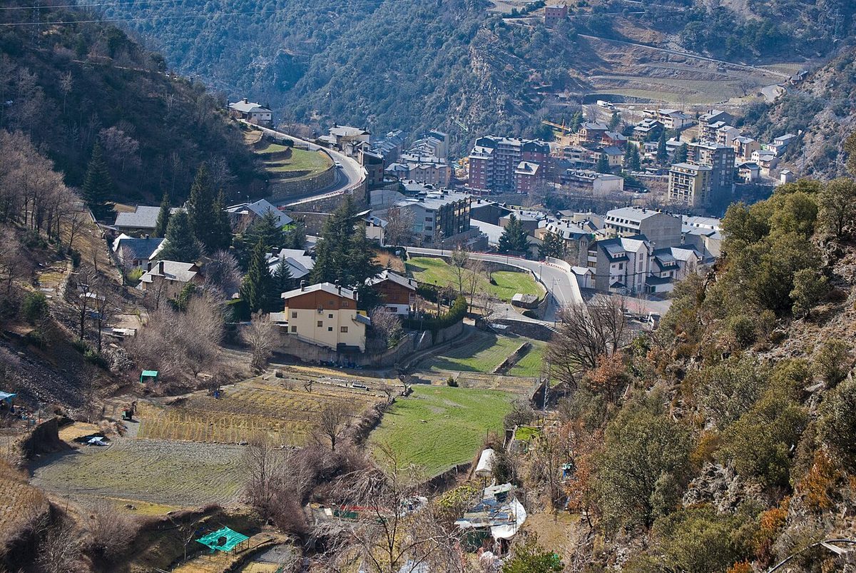
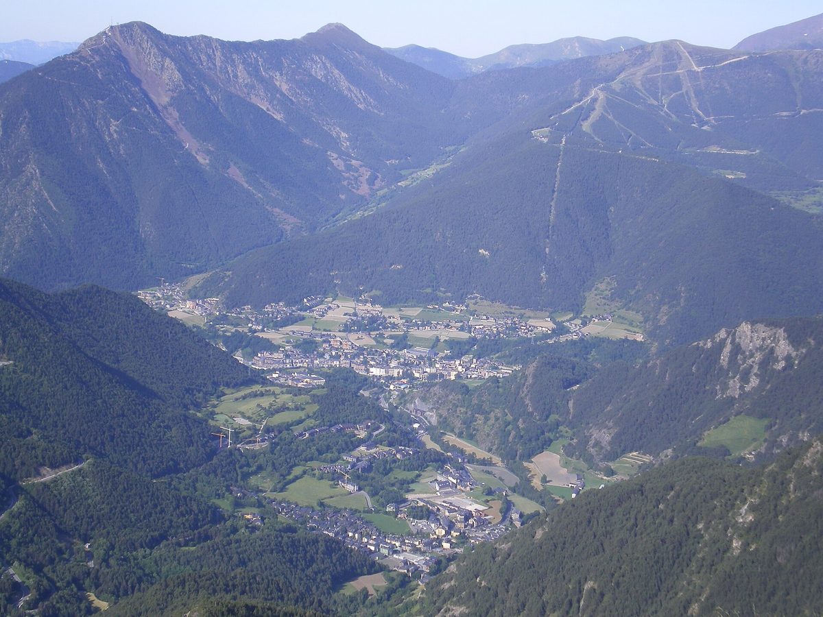
Os de Civís sits in the vall d’Aós, where the Setúria and Salòria rivers meet. Water from this valley flows north-east into the Valira — Andorra’s river. Hydrographically, geographically, in every sense that matters to a person on foot or in a car, this valley belongs to the Andorran side of the range.
Administratively it has always been Catalan, and that has never been disputed. The land belonged historically to the viscounty of Castellbò, and the village was part of the Spanish municipality of Civís until 1970, when Civís was folded into the larger municipality of Les Valls de Valira. So the border here does not follow the watershed, as mountain borders usually do. It follows an older line of lordship and parish — leaving a Spanish village in an Andorran-facing valley with a wall of 2,000-metre ridges between it and the rest of its own country.
The pass that should have been the road, and never was
There is a way through to the rest of Spain on the ground. It runs over the collada de Conflent, a saddle measured at around 2,177 m (older sources round it to 2,150 m), and drops into the valley of Santa Magdalena.
People used it for centuries. Shepherds drove flocks over it, smugglers used it, and until the road came it was how Os de Civís talked to Civís, Ars and La Seu d’Urgell. But it is a rough unsurfaced track over a high col, snowbound for months, and no Spanish government ever built a proper road across it. Paving a route over 2,177 m to serve a few dozen people was never going to happen when a far shorter, far lower road already existed on the Andorran side. So the anomaly hardened into permanence.
What a “pene-enclave” actually is
The technical term is pene-enclave (or practical enclave, or in Catalan periclavament): a piece of territory physically joined to its own country — you could walk there without leaving Spain — that in practice can only be reached by crossing into another state. It is rarer than a true enclave and it is almost always a mountain or water problem rather than a political one. The Northwest Angle of Minnesota, cut off by the Lake of the Woods and reachable by road only through Canada, is the classic comparison. Os de Civís is Europe’s neatest example, and the only one of its kind in Spain.
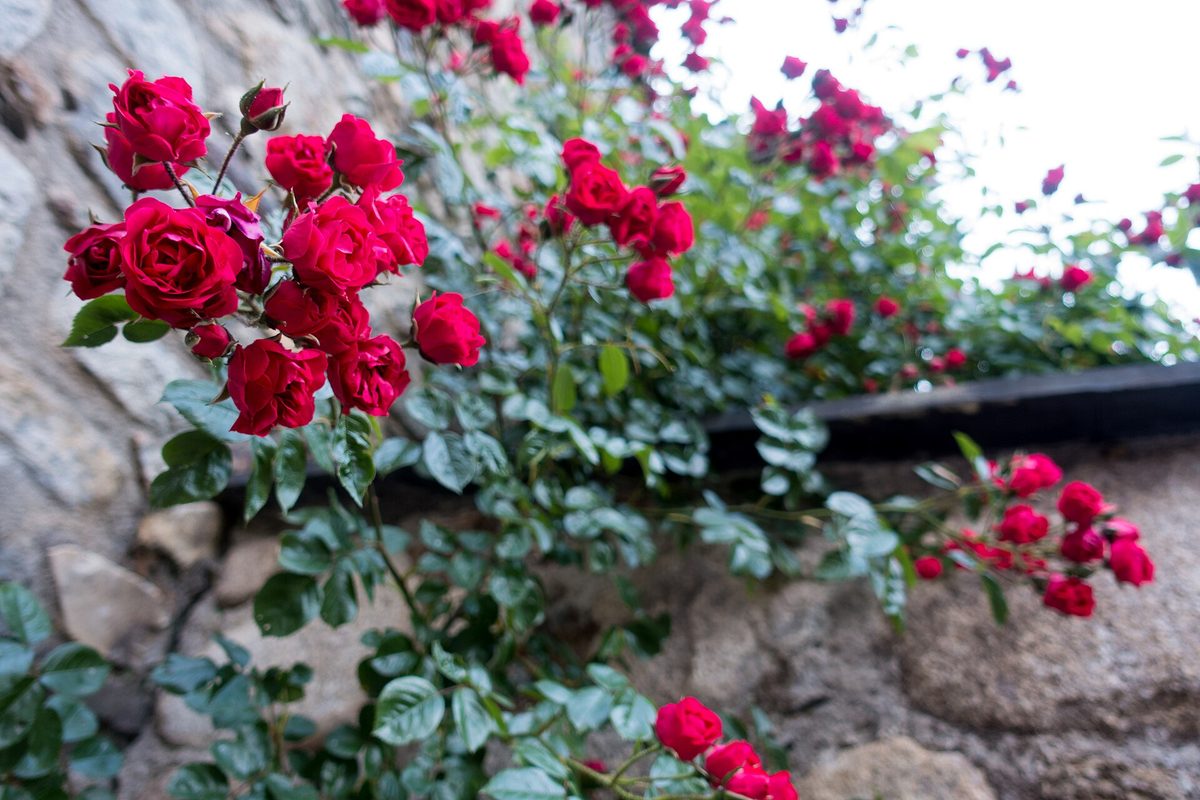
Os de Civis or Os de Civís?
Both, and a couple more besides. The Catalan spelling is Os de Civís, accent on the final syllable — say it roughly “oz duh see-VEES”. Drop the accent and you get Os de Civis, which is what most mapping apps and English-language articles use, so do not panic if your satnav offers you that.
Locally you will also hear Aós de Civís, and the village was historically called Os d’Urgell. “Civís” is the neighbouring village and the old parish name; it appears in the consecration record of the cathedral at La Seu d’Urgell as far back as 839, as Civici.
Spain on paper, Andorra in practice: what is actually true
This is where the recycled travel writing gets sloppy, so let me separate what I could verify from what I could not.
The Spanish half of the ledger
Os de Civís is unambiguously Spain. Spanish and Catalan law apply, it is counted in the Spanish census, it votes in Spanish and Catalan elections, and policing is the job of the Mossos d’Esquadra, Catalonia’s regional force, not Andorra’s. Administrative and court business goes down to institutions in the Alt Urgell. Its postcode is a Lleida one, 25788.
The village also has a real slice of self-government within the Spanish system: it is an entitat municipal descentralitzada, roughly a parish council with genuine powers, inside the municipality of Les Valls de Valira. It is the most populated settlement in that municipality, which tells you how empty this corner of the Pyrenees is.
Here is the one that surprises people: the electricity is Spanish, not Andorran. Catalan sources are explicit that supply comes from the Urgell company PEUSA, arranged after the catastrophic floods of 1982 that cut the village off entirely and left it without a telephone line. You will read the opposite on a dozen travel blogs. As far as I can establish, they are wrong.
The Andorran half
Almost everything else in daily life leans north. The comú — the parish council — of Sant Julià de Lòria provides the practical services: rubbish collection, road cleaning, snow clearing. Village children are educated in Andorran schools, because the alternative is a two-hour round trip over a mountain that is impassable half the year. Residents shop, refuel and see doctors in Andorra for the simple reason that it is twenty minutes away and the rest of Spain is not.
The road is the clearest expression of the arrangement. The CG-6 is an Andorran general road, and unlike every other road in the country it does not stop at the frontier: it crosses the border and finishes in the middle of a Spanish village, and Andorra maintains and ploughs it. That is an unusual thing for one country to do for another, and it works because there is no alternative and everybody knows it. Park in the village and look at the number plates — a striking proportion are Andorran. That is the arrangement in a single glance.
What I could not pin down
Mobile networks. Older Spanish sources say telephony and internet reach the village via Telefónica, which would make it a Spanish network. I could not confirm the current situation, and in any case your phone will probably hop onto Andorra Telecom’s signal somewhere on the drive up, because those are the masts you are passing. Andorra is not in the EU, so EU roaming rules do not cover it and charges can be unpleasant. Turn data off before you set out, or sort a local SIM in Sant Julià.
Water and other utilities. I have seen claims in both directions and could not verify them from a source I trust. Treat any confident statement about who pipes the water — mine included, which is why I am not making one — with scepticism.
The border with no border
Andorra is in neither the European Union nor the Schengen area, and it runs full customs checks at every one of its frontier posts with Spain and France. Every one except this one.
The crossing on the CG-6 is unmanned: no barrier, no booth, no officer, no stamp — which is fine, because Andorra does not stamp passports anywhere. The logic is simple. The road dead-ends in Os de Civís and cannot be used to reach anywhere else in Spain. Policing it would be policing a cul-de-sac.
Carry ID anyway. You are legally crossing an international frontier twice, and if anything goes wrong up there you want to prove who you are. My guide to passport and ID rules for Andorra covers the documents question, and the mechanics of crossing the Andorran border — including the queues at La Farga de Moles that you are cheerfully bypassing — are worth reading if you are driving in from Spain anyway.
The duty-free nuance nobody explains
Here is the bit that makes customs lawyers wince. Andorra’s low taxes are why half its visitors come, and there are strict limits on what you may take out. Driving from Aixovall to Os de Civís, you are legally exporting goods from Andorra into Spain, and the allowances technically apply — even though nobody is there to check.
In practice nobody loads a car with cigarettes to drive up a dead-end valley, and there is no post to stop them if they did. The frontier is quiet not because the rules were waived but because the geography makes abuse pointless. Historically it was a different story: these valleys were smuggling country for generations. If you are doing any real shopping in the country, read the current Andorran duty-free allowances before you load the boot, because the checkpoints at the main crossings do enforce them.
One practical corollary: the euro is the currency on both sides, so there is nothing to change. Andorra uses the euro without being an EU member, which trips people up more often than it should — I unpack that in the guide to money and currency in Andorra.
Driving the CG-6: the only road in
Nine kilometres, about 700 metres of climb, and one of the more entertaining short drives in the Pyrenees.
The route, turn by turn
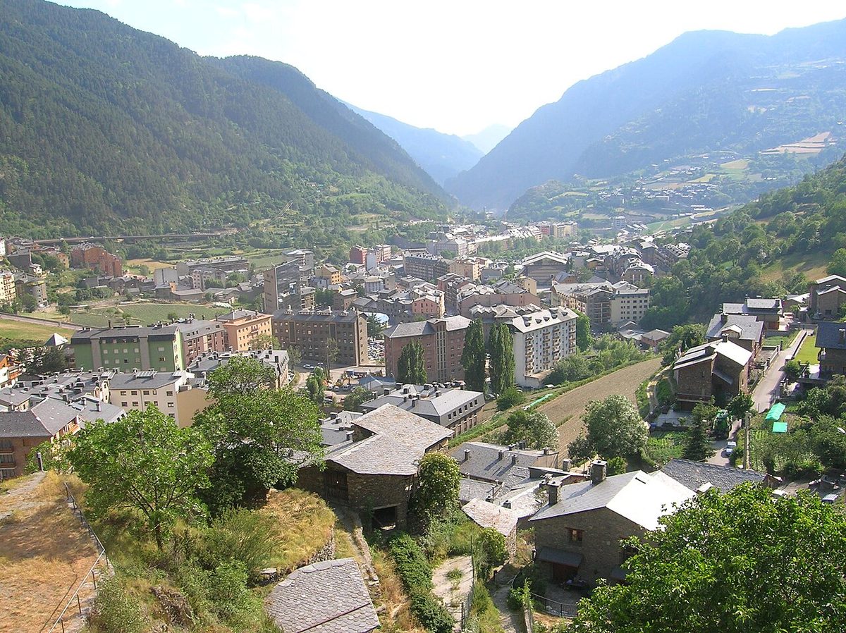
Start in Sant Julià de Lòria, Andorra’s southernmost parish town, and head north on the CG-1. Two or three minutes later you reach the Aixovall roundabout, unmistakable because the sports stadium sits beside it. Leave the CG-1 there and take the CG-6, signed for Bixessarri and Os de Civís.
From the roundabout it is about 8 km to the village. The road climbs west through the gorge of the riu d’Os, passing the hamlet of Bixessarri — around 40 residents at the last count I could find, and the turn-off for the sanctuary of Canòlich, a worthwhile five-minute detour and the focus of Sant Julià’s biggest festival on the last Saturday in May. About 6 km up you pass Els Prats de la Farga, a big riverside picnic area with something like nine barbecues and a couple of dozen tables across four zones, packed with Andorran families every summer weekend. Shortly after it, without ceremony, you are in Spain. Two more kilometres and the road ends in Os de Civís.
What the road is actually like
Narrow, twisting, well surfaced for most of its length, and steeper than it looks — cyclists who log it record an average gradient of around 7.5% with ramps hitting 15%. It is a two-way road that in places feels like one and a half, with rock on one side and a drop on the other, and you will meet delivery vans coming the other way.
None of that makes it frightening. It makes it a road you drive at 40 km/h with both hands. Andorra has spent real money making it safer: the government installed dynamic rockfall barriers along the Aixovall–Os stretch, having classified it as a high-risk zone. Take that as a hint about what the cliffs above you occasionally do. If you are not used to Pyrenean mountain roads, my broader guide to driving in Andorra is worth ten minutes before you set off.
Winter, snow and closures
There is no seasonal closure. People live here year-round, Andorra ploughs the route, and the CG-6 is kept open through winter as routine rather than heroics.
That is not the same as always open. Rockfalls and river damage have closed it — in one episode a slide at the border point cut the road entirely and the only way out was a four-wheel-drive forest track down to Civís. When that happens the village is genuinely isolated, which is the sharpest possible reminder of what a pene-enclave means.
In practice: in winter carry chains or fit winter tyres, check conditions before you leave, and do not attempt the climb in a low-slung hire car after fresh snow. Andorra’s winter driving rules are strict and sensibly so — I go into them in the guide to Andorra in winter. Chains for a rental are usually an extra you have to ask for.
Parking, buses and the road above the village
There is parking at the entrance to the village and along the approach. Do not try to drive into the old core: the lanes are cobbled, steep and were designed around mules. Leave the car and walk, which takes about four minutes end to end.
The tarmac continues above the village for another kilometre and a half, past the hotel, then turns into a forest track. Cyclists grinding up from Aixovall count the hotel as the top of the climb at roughly 1,635 m, and they will tell you the stretch above the houses is the cruellest bit — rough surface, gradients into the high teens.
And to save you a search: there is no scheduled bus to Os de Civís. Andorra’s public network is genuinely good and cheap — the L1 gets you to Sant Julià de Lòria for pocket change — but it stops well short of this valley. Your options are a car, a taxi from Sant Julià, a bike, or a long walk. For everything the buses do cover, see my guide to getting around Andorra.
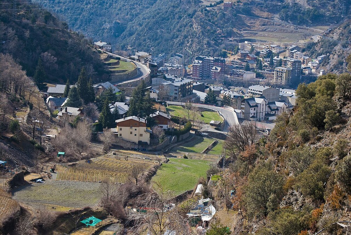
What there is to see when you get there
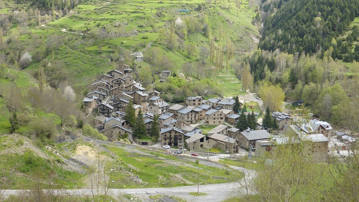
Manage your expectations and you will have a lovely time. This is a village of perhaps forty or fifty houses. There is no museum of note, no castle to tour, no ticketed anything. What there is, is a remarkably intact piece of Pyrenean vernacular architecture in a spectacular bowl of mountains.
The church of Sant Pere
Get this right, because plenty of write-ups do not. The parish church is dedicated to Sant Pere — Saint Peter; some Catalan sources give the fuller dedication as Sant Pere i Santa Margarida. It is not, whatever you may read, a Sant Julià.
It stands at the top of the village, reached by a steep cobbled lane, and it is simple Romanesque: a single nave with side chapels and a square bell tower. It is believed to have doubled as a fortification — a castle, in the loose medieval sense — which explains why it commands the hill the way it does. The views back down over the slate roofs are the best in the village and cost nothing.
The church was ruinous for much of the twentieth century. It owes its survival to the Associació d’Amics d’Aós de Civís, a friends-of-the-village group founded after the 1982 floods, partly by Barcelonans who had fallen for the place, which pulled in restoration grants for the porch and the fabric of the building. The same movement is why so many of the houses look loved rather than derelict. One casualty of the neglected years: the church’s Gothic mural of the Last Supper, a fresco a little over two and a half metres wide, now lives in the Museu Diocesà d’Urgell down in La Seu d’Urgell.
The streets, the stone, and why it looks so preserved
Os de Civís was a vila closa — a closed, walled village — and you can still feel the shape of it. The lanes are narrow, cobbled and awkward, the houses are stone with slate roofs, and the wooden balconies carry the geraniums every Pyrenean village seems contractually obliged to grow.
Why does it look this good when so many mountain villages are half-ruined? Two reasons, neither romantic. First, isolation: nobody built a concrete apartment block here because nobody could easily get the concrete up. Second, second homes. When the road and the restoration movement arrived, Barcelona and Andorran money bought and rebuilt the old houses rather than replacing them. The result is a village that is beautifully kept and, for much of the year, fairly empty. Around 70 people are registered here; on a February Tuesday it feels like fewer.
Look for the old colomar on the sunny side of the village — a squat stone tower that was a private dovecote, kept for meat and for pigeon guano to fertilise the vegetable terraces. It tells you more about how this place survived than any information panel.
The Terres de Frontera visitor centre
The old school building houses a small visitor centre called Terres de Frontera — “border lands” — which doubles as an information point for the Parc Natural de l’Alt Pirineu. The exhibition is about exactly what you would hope: how border territories work, what gets traded across them, where they clash and where they cooperate. For a village that is a living case study, it is a smart use of a building. It is seasonal, with limited hours weighted towards summer and early autumn, so check the park’s own site before counting on it. Twenty minutes, not an afternoon — but it is the only place that explains the thing you came to see.
Lunch: the honest reason Andorrans drive up here
Let me be blunt about the tourism proposition. If the geographic oddity were removed, Os de Civís would still get visitors, and they would still be coming for the same thing: a long lunch of grilled meat in the mountains.
This is a well-established Andorran weekend ritual. You drive up on a Sunday, walk round the village for half an hour, sit down at one, and emerge at half past three considerably heavier. The cooking is Pyrenean-Catalan and completely unreconstructed: embotits (cured pork and mountain charcuterie), lamb, kid and game grilled over charcoal or a wood fire, escudella in winter, calçots in their short late-winter season, and something custardy for pudding.
The best-known address is the Hotel Os de Civís, just above the village on the continuation of the road, with a proper grill, a terrace and a set menu. There are a handful of other restaurants and hostals in and just below the village, some family-run for decades. I am deliberately not listing them all, because in a village this size businesses open, close and change hands, and the last thing you want is to drive nine kilometres of hairpins to a locked door.
What I will give you is the practical shape of it, all of which I would still check before setting off:
- Book at weekends. Sunday lunch fills with Andorran families and there are not many tables in this valley.
- Go for lunch, not dinner. Kitchens follow Spanish hours — lunch from around 1:30 pm — and several places do not serve in the evening outside high season.
- Expect a set menu. The menú format is the norm and the value play, typically three substantial courses, priced like rural Catalonia rather than a ski resort.
- Midweek in the shoulder seasons is a gamble. Some kitchens close in November and again after the New Year. Phone.
- Cards are normal, but a small village is a small village — do not arrive with nothing.
If you want to know what you are ordering before you sit down, my guide to Andorran and Pyrenean food runs through escudella, trinxat, the charcuterie board and the wine, all of which turn up here in almost identical form. The border does not change the cooking much.
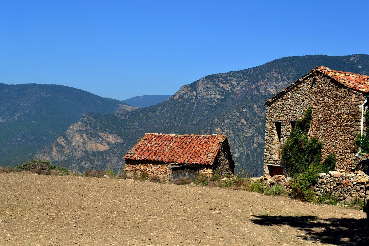
Walking above the village
The village sits inside the Parc Natural de l’Alt Pirineu, created in 2003 and the largest protected area in Catalonia. That is the real reason to give Os de Civís more than an hour: the walking above it is excellent and almost nobody does it.
The collada de Conflent
The signature walk climbs to the col that was once the village’s lifeline. From the track above the hotel it is a steady hour and a quarter alongside the riu Salòria, through pine and fir and past the subalpine hay meadows of the pla de la Cabana, to the collada de Conflent at roughly 2,177 m. A popular circular version returns over Servellà and down through the Obaga d’Os woods: call it 10 km, 550 m of ascent, three hours of walking. Start from the village itself rather than the track and you add roughly 4 km and 200 m of climb, which is the honest way to do it.
The park has waymarked itineraries from the village — a Salòria river route, a Setúria river route, one to Montaner — signed with yellow paint flashes and vertical posts. From the col you look at the pic de Salòria, at 2,789 m the highest summit in the Alt Urgell, and down two valleys at once. There is a fair chance you will have it to yourself.
The bunkers nobody expects
Around the collada de Conflent are concrete machine-gun nests you can walk into. They belong to the Línia P, the belt of thousands of fortifications the Franco regime threw along the Pyrenean frontier after the Spanish Civil War, aimed partly at anti-fascist guerrilla incursions and partly at an invasion that never came. Standing inside one at over 2,000 m, looking down a valley with no road to Spain, is a genuinely strange twenty minutes. Below the col on the western side are the bordes de Conflent, a cluster of old stone barns notable for having their own chapel and thick with contraband legend — this was tobacco smuggling country for generations.
Walking on to Civís and Ars
You can walk from Os de Civís to Civís and on to Ars; the old shepherds’ and smugglers’ paths are still there. It is proper mountain walking over the ridge, not a stroll, and you need a map, decent legs and a plan for getting back, because there is no public transport at either end and no road linking them. Realistically it is a full day for experienced walkers and makes most sense as a point-to-point with a car shuttle. If you want something gentler, my roundup of hiking in Andorra points at valleys with better infrastructure, and the overview of Andorra’s nature parks is the natural companion to the Alt Pirineu on this side of the frontier.
The Port de Cabús — a different back door entirely
People often mention the Port de Cabús in the same breath as Os de Civís, so let me be precise: the two are not connected by road.
The Port de Cabús is a pass at 2,304 m on the Andorra–Spain frontier, Andorra’s second-highest after the Port d’Envalira. You reach it from La Massana, not from Sant Julià, climbing the CG-4 past Coll de la Botella and the Pal-Arinsal ski area — about 17.7 km of road gaining nearly 1,100 m, and only the Andorran side is paved. Over the top, the way into Catalonia is an unsurfaced track that eventually reaches Tor, a near-abandoned hamlet in the Pallars Sobirà with a dark modern history of killings over the ownership of the mountain and a long past as a smugglers’ route. The track is rough, private in places, and buried in snow much of the year. It is not a shortcut and it is not a route to Os de Civís. Check locally before attempting it in anything but high summer.
Planning a visit: the practical bits
- How long to allow. Two hours if you are ticking off the curiosity and taking photographs. Four to five for a proper lunch. A full day if you walk to the collada de Conflent as well, which is the version I would choose.
- Best time to go. Late spring through October. June and September are ideal: meadows alive, walking open, restaurants on normal hours. Autumn colour in the Obaga d’Os woods in mid-October is superb.
- Winter. Beautiful and viable if you are equipped, but check the road and phone the restaurant. Snowshoeing the tracks above the village is a real option.
- What it costs. The village is free. Budget a set lunch and fuel and that is the trip — one of the cheapest half-days in the country, which matters in a place as pricey as Andorra can be.
- Facilities. Restaurants, hostals and a rural guesthouse or two. Do not count on a shop, a cash machine or a petrol station. Fill up in Sant Julià, where fuel is cheap anyway.
- Combine it with. The Canòlich sanctuary on the way up, the Tobacco Museum down in Sant Julià, or the Prats de la Farga picnic area if you have children and a bag of sausages.
It slots neatly into a broader plan too. It is one of the more rewarding day trips from Andorra, it belongs on any list of unusual things to do in Andorra.
Is Os de Civís worth the detour? My honest verdict
Yes — with conditions.
Go if you like maps, borders and the small absurdities of how Europe is stitched together, because this is one of the best examples on the continent and it is twenty minutes away. Go if you want a proper mountain lunch in a village that has not been prettified for tourism. Go if you are a walker, because the Alt Pirineu above the village is quiet, wild and genuinely good.
Do not go expecting a sight. There is one Romanesque church, one small exhibition and about four hundred metres of cobbled lane. Arrive on a wet Tuesday in November with the restaurants shut and you will have driven an hour for a damp photograph and a shrug. The village is the setting for an afternoon, not the content of one.
And do not go for the border theatre. There is no barrier, no guard, no dramatic moment — just a modest marker and a change in the road signs. That anticlimax is, I think, the actual point: this is what a frontier looks like when geography has quietly overruled politics and everybody has got on with it for a few hundred years.
Set against the rest of the country’s mountain villages, Os de Civís is not the prettiest — Ordino and Pal have it beaten on looks. It is the most interesting. That is a different and, for my money, better reason to drive somewhere.
Frequently asked questions
Is Os de Civís in Spain or Andorra?
Spain, without any ambiguity. It is in Catalonia, in the province of Lleida and the comarca of Alt Urgell, within the municipality of Les Valls de Valira. Spanish and Catalan law apply and Catalonia’s Mossos d’Esquadra police it. The confusion comes from the fact that its only road, its rubbish collection, its snow ploughs and its schools all come from Andorra.
Why can you only reach Os de Civís through Andorra?
Because of the mountains. The village sits in a valley that drains north into Andorra’s Valira river, walled off from the rest of Spain by ridges over 2,000 m. The historic route out, over the collada de Conflent at about 2,177 m, is a rough unsurfaced track that no one ever paved. Building a road over it for a few dozen people never made sense when a short, low road already existed on the Andorran side.
Do you need a passport or go through customs to visit?
There is no customs post and no border control on this road — the only unmanned crossing on Andorra’s frontier, because the road dead-ends in the village and leads nowhere else in Spain. You are still legally crossing an international border twice, so carry ID. Andorra’s duty-free export limits technically apply on the way out, even though nobody is there to check.
How many people live in Os de Civís?
Around 70. Spanish national statistics recorded 73 registered residents in 2025 and 67 in 2024. You will see much higher numbers quoted from the 2000s, when the count topped 150, and one widely repeated figure of 25 that I could not reconcile with the official series. Many houses are second homes, so the winter population feels smaller still.
How do you get to Os de Civís from Andorra?
Drive. Take the CG-1 from Sant Julià de Lòria to the Aixovall roundabout, then the CG-6 west, signed for Bixessarri and Os de Civís. It is roughly 8 km from the roundabout and about 20 to 25 minutes from Sant Julià. There is no bus, so a car, a taxi or a bicycle are your only options.
Is the road to Os de Civís open in winter?
Normally, yes. Andorra maintains and ploughs the CG-6 all the way into the village, because people live there year-round. It can still close temporarily after rockfalls or storm damage, and it is a steep, narrow mountain road, so carry chains or winter tyres and check conditions before you set off.
What is there to do in Os de Civís?
Walk the cobbled lanes, climb to the Romanesque church of Sant Pere for the view, look in at the small Terres de Frontera visitor centre, and eat a long lunch of grilled meat and charcuterie. Then walk: the trails into the Parc Natural de l’Alt Pirineu above the village, particularly the circuit to the collada de Conflent, are the best thing here.
Can you walk from Os de Civís into the rest of Spain?
Yes, on foot. Old paths cross to Civís and Ars and over the collada de Conflent into the Santa Magdalena valley. They are proper mountain routes rather than strolls, they need a map and a full day, and there is no public transport at either end to get you back. That is precisely why the road was never built.
One last thought before you drive up
What stays with me about Os de Civís is not the border trivia. It is the ordinariness of it. A man was unloading crates outside a restaurant, a dog was asleep in the lane, and the frontier between two sovereign states ran through the trees a kilometre down the road without anybody paying it the slightest attention. Europe’s oddities are mostly like this in person: quieter, smaller and more practical than the internet promises.
Give it a Sunday. Drive up slowly, walk the lanes, climb to Sant Pere, eat far too much, and then, if the weather is kind, keep going up the track towards the col and look back down at a Spanish village facing the wrong way.
To place it in context, start with the guide to Andorra’s best villages and the parish it depends on, Sant Julià de Lòria. The background on the history of Andorra explains a lot about why the borders here look the way they do.
Photo credits
All photographs are from Wikimedia Commons under their stated licences, with thanks to the photographers: